
Anthony Licciardello | July 16, 2026
Staten Island
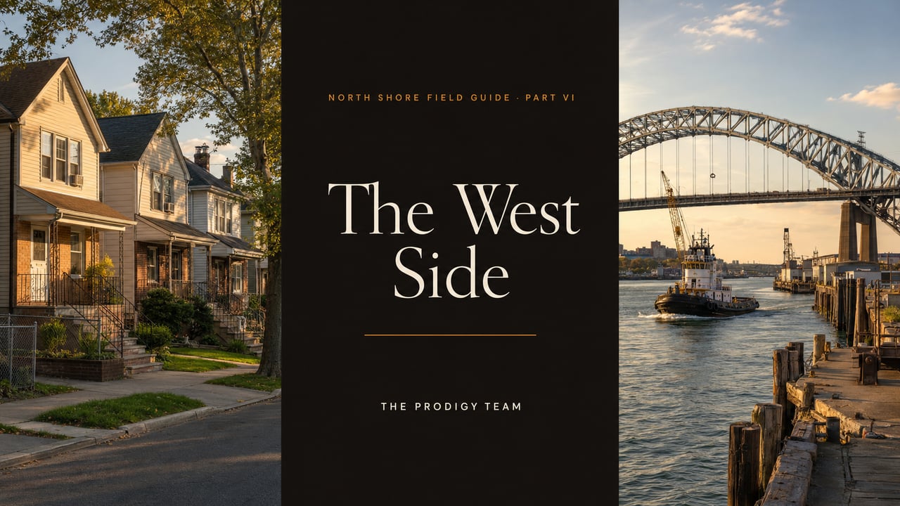
The last stretch of the North Shore where a working family’s budget still buys a whole house — and an honest accounting of what that discount is actually paying for. Mariners Harbor, Port Richmond, and the 70-year-old transit promise running through both.
The West Side — Mariners Harbor and Port Richmond, with Arlington and Elm Park folded in — is where the North Shore’s affordability math still works. Mariners Harbor’s median sale price of $550,000 sits roughly $184,000 below the borough’s mid-2026 median, and it is the last submarket above the Expressway where detached and semi-detached houses reliably trade under $600,000.
The discount is real, and so is what it prices in: an industrial working waterfront, a commercial corridor still mid-transition, thin closed-sale volume that makes comps treacherous, and a transformative transit project — the North Shore BRT, with a planned Mariners Harbor station — that has a completed environmental review but not yet a construction shovel. This installment is the honest ledger of both columns.
Every field guide needs a chapter where the tourist maps run out. On the North Shore, that chapter is the West Side. The Ferry Corridor gets the renderings, the Victorian Belt gets the architecture tours, the hills get the sightlines — and the stretch of the island running west along the Kill Van Kull toward the Bayonne Bridge and the Goethals gets a shrug. That shrug is a pricing error. This is the part of the North Shore doing the quiet, essential work of the whole borough: housing the buyers the rest of the market has priced out, moving the freight, and holding the one piece of infrastructure — a dormant rail right-of-way — that could reprice everything around it. This closing installment completes the map Part I opened.
Start with the number that defines the submarket. Mariners Harbor’s median sale price over the trailing twelve months is $550,000, up about 3% year over year, with homes going under contract in roughly 52 days. Set that against the borough-wide median of approximately $734,000 as of mid-2026 — our Staten Island market report tracks the borough-level trend in full — and the West Side discount comes into focus: about $184,000, a quarter of the borough median, for a market fifteen minutes from the same ferry terminal.
Translate that into a monthly payment and the discount gets louder. At prevailing mid-6% mortgage rates, the gap between a $550,000 purchase and a $734,000 purchase is well over $1,100 a month in principal and interest alone. For the buyer profile that dominates here — first-timers, two-income working families, Brooklyn transplants chasing a detached house with a driveway — that monthly difference is not a preference. It is the difference between qualifying and not qualifying.
The stock delivering that math is exactly what the rest of the North Shore ran out of: older semi-detached and modest single-family houses, postwar townhouse rows, and a meaningful two-family inventory — multi-family listings in Mariners Harbor currently range from the low $400,000s to just over $1 million, putting owner-occupant house-hacking within reach in a way it simply isn’t in the Ferry Corridor anymore. Newer infill construction has been threading into both neighborhoods for years — builders see the same arithmetic buyers do.
“Under $600K” is a submarket statement, not a guarantee on any given block. Well-renovated singles on the better Mariners Harbor and Port Richmond streets clear $650,000+, and new-construction two-families push past $900,000. The point is that the median lives under $600K here — the only North Shore submarket where that’s still true — while everywhere east of Jewett Avenue the median has left that number behind.
Mariners Harbor is the volume market of the two. A former oyster port and shipyard community that today reads as one of the island’s most multicultural neighborhoods, its housing runs from older semis to modest detached singles to townhome rows, with genuine investment stock mixed in. It trades — the 52-day contract pace is close to the borough norm — but in two speeds: entry-level and correctly priced mid-range homes move on schedule, while higher-priced West Side inventory has been among the borough’s slowest movers this year, some of it stretching past 110 days on market. Sellers who price a Mariners Harbor house against renovated West Brighton comps learn this lesson expensively.
Port Richmond is the history-and-corridor play. One of Staten Island’s oldest communities — the Dutch were burying North Shore settlers here in the 1600s — it holds a stock of early-twentieth-century colonials that would carry a six-figure architecture premium two neighborhoods east, plus the Port Richmond Avenue commercial corridor, today a center of the island’s Mexican-American commercial life. The Bayonne Bridge lands here, putting New Jersey minutes away — a genuine two-state commute asset. The Port Richmond neighborhood guide carries the canonical overview.
Port Richmond’s challenge is statistical, not physical: closed-sale volume is thin, and thin volume makes monthly medians nearly useless. This past January the recorded median printed at $665,000 — a huge year-over-year jump — on all of three closings; the following month didn’t clear the reporting threshold at all. Nobody should price a Port Richmond house, in either direction, off a three-sale median. This is a comp-by-comp, block-by-block market, and conditions shift meaningfully between the avenue corridor, the residential southern blocks toward Forest Avenue, and the waterfront-adjacent north.
Running along the Kill Van Kull through both neighborhoods is the single most consequential piece of dormant infrastructure on Staten Island: the former North Shore Railroad right-of-way. Passenger trains ran this line from 1886 until 1953 — there was a Mariners Harbor station, and photographs of it survive — and for seventy years since, every conversation about the West Side’s future has orbited whether service ever comes back.
The current answer is the North Shore Bus Rapid Transit project: an approximately eight-mile alignment between West Shore Plaza and the St. George Terminal, built from roughly 4.8 miles of the old rail right-of-way plus 3.2 miles of city streets, with at-grade, elevated-viaduct, and open-cut sections. The plan calls for two terminals, seven fixed stations, and three on-street stops, run with electric buses — and it explicitly includes a Mariners Harbor station, putting this neighborhood back on a fixed-guideway transit map for the first time since Eisenhower’s first term. Dedicated-lane service into St. George means a protected, traffic-proof connection to the ferry and its 25-minute ride to Lower Manhattan.
Here is the honest-read part, because this series has a policy about renderings. The MTA has completed the Final Environmental Impact Statement under SEQRA — a genuine, non-trivial milestone that puts the BRT further along than any North Shore transit revival before it. What the project does not yet have is a committed construction budget and a published service date. Transit priorities get reshuffled, and a completed EIS is a license to build, not a guarantee of building.
Do not pay a transit premium for a line that isn’t funded. Buy the West Side on today’s math — the $550,000 median, the two-family income, the bridge access — and treat the BRT as free upside if it breaks ground. Any listing marketing “steps from the future BRT station” as a present-value feature is asking you to pay now for a project with no construction date. The right-of-way has been “about to come back” since 1953. Let it surprise you.
The West Side’s discount has causes, and pretending otherwise would violate the charter of this series. The first is that this waterfront still works for a living: the city’s container port operates at Howland Hook beneath the Goethals Bridge, ship repair has run on the Kill Van Kull for over a century, tugboats berth along the shore, and the western portion of that famous right-of-way isn’t entirely dormant — it carries freight from Arlington Yard into New Jersey. For the borough’s economy this is an asset. For a homeowner three blocks from it, it is truck traffic on the arterials, industrial neighbors on the waterfront blocks, and a soundtrack the Victorian Belt doesn’t have.
The second is water. Low-lying blocks near the Kill Van Kull carry flood-zone designations, and on the North Shore — as Part V covers for the Bay Street corridor — the flood map is a pricing document. Before contract, pull the FEMA panel for the specific address, get an insurance quote in hand, and ask for the elevation certificate. A $550,000 purchase with a four-figure annual flood premium is a different purchase.
The third is texture: these are not uniform neighborhoods, and averages flatten differences that matter at the block level. School zoning, corridor condition, proximity to industrial parcels, and public-safety statistics all vary street by street — the area is covered by its own precinct, the 121st, with current data publicly available through the NYPD’s CompStat portal. The buyers who do well here walk the block at three different hours before they offer. The ones who regret it bought the average instead of the address.
Before offering on any West Side property: ① pull the FEMA flood panel and price the insurance; ② map the parcel against the rail right-of-way and active industrial lots — adjacency cuts both ways; ③ pull twelve months of true block-level comps rather than neighborhood medians; ④ walk the block on a weekday morning, a weekday evening, and a weekend. Four steps, one afternoon — and they will tell you more than any listing description.
Buyers: this is the submarket where the borough’s affordability math still closes, so underwrite it on present-day fundamentals — price per square foot, rental income on the two-family stock, bridge and ferry access — and take the corridor’s upside stories as optionality you didn’t pay for. The two-family inventory deserves particular attention: at West Side acquisition prices, a legal rental unit can cover a meaningful share of the mortgage — a structural advantage no East Shore submarket can still offer at these numbers — and the city’s new zoning widens the play further; our guide to New York’s changed ADU rules covers what’s now buildable as-of-right, including the flood-zone restrictions that matter on West Side blocks.
Sellers: the two-speed market is the whole game. Entry and mid-range homes priced to the block’s actual comps are moving in roughly seven weeks; the higher-priced segment is where West Side listings go to age, and that 110-day tail is almost entirely self-inflicted pricing against the wrong neighborhoods. If your home genuinely tops the local range, the marketing has to import the buyer — we’ve written about how Staten Island’s best-marketed listings actually get sold — making the value case against West Brighton or Westerleigh pricing explicitly, with presentation those buyers expect, because the West Side’s walk-in traffic won’t reach your number. For the cross-borough comparison, our East Shore budget-fit guide runs the same honest math east of the ferry.
“The West Side is the last place above the Expressway where a working family’s number still buys a whole house. My job isn’t to romance the discount — it’s to make sure you know exactly what it’s paying for, block by block, before you sign.”
— Anthony Licciardello, Broker, The Prodigy Team
Every guide on this site is part of a system: town-by-town content clusters, dedicated neighborhood pages, and cross-state marketing engineered for one outcome — putting your listing in front of the motivated New York families already searching for it. I’m Anthony Licciardello, Broker of The Prodigy Team — a former Director of Community Affairs in the Bloomberg Administration and a member of the Staten Island Growth Management Task Force — and this pipeline is what 22 years and 5,000 closings taught me to build.
Our Above the Streets cinematic drone series extends that reach — aerial storytelling that markets entire towns, not just listings, with audience performance exceeding industry benchmarks for real estate media.
Anthony Licciardello · Broker, The Prodigy Team · 718-873-7345
Cross-market pipelines, aerial video, and block-level pricing built for exactly this submarket. Let’s talk about what your home is worth — and who’s actually going to buy it.
Where can I still buy a house under $600K on Staten Island’s North Shore?
The West Side — Mariners Harbor, Port Richmond, and adjacent Arlington and Elm Park — is the last North Shore submarket where the median sale price sits under $600,000. Mariners Harbor’s trailing median is $550,000, roughly $184,000 below the borough-wide figure, with semi-detached, modest single-family, townhome, and two-family stock delivering most of that value.
Is the North Shore BRT actually happening?
The MTA has completed the Final Environmental Impact Statement for the roughly eight-mile line between West Shore Plaza and St. George, which would reuse 4.8 miles of the former North Shore Railroad right-of-way and include a Mariners Harbor station. That is the furthest any revival of the corridor has advanced since passenger service ended in 1953 — but the project does not yet have a committed construction budget or service date, so buyers should treat it as upside rather than a priced-in amenity.
Why do Port Richmond’s reported home prices swing so much month to month?
Thin transaction volume. Some months record only a handful of closings — January 2026’s reported $665,000 median rested on three sales — so a single high or low closing can move the printed median dramatically. Price a Port Richmond home from direct block-level comparables over the trailing year, never from a single month’s neighborhood median.
What should I check before buying near the Kill Van Kull waterfront?
Four things: the FEMA flood panel and an actual insurance quote for the address; the parcel’s position relative to the rail right-of-way and active industrial lots; twelve months of true block-level comparables; and the block itself, walked at different hours. The West Side’s discount is rational — due diligence confirms which of its causes apply to your specific address and which don’t.
Part I: The North Shore, Decoded
Part III: The Victorian Belt
Part IV: Quiet Money Hills
Part V: The Bay Street Renaissance
Port Richmond Neighborhood Guide
Mariners Harbor figures per Homes.com trailing-12-month neighborhood data (through June 2026); Port Richmond per PropertyShark residential trends (Q1 2026, small-sample caveat); borough median compiled from MLS and public records, mid-2026. North Shore BRT alignment, station plan, and Final Environmental Impact Statement per MTA project documentation and the NYSDEC Environmental Notice Bulletin. Historical rail service dates per North Shore Branch records, Staten Island Railway (1886–1953). Neighborhood medians are small-sample statistics and subject to revision. This post is general information, not investment advice.
Prodigy Real Estate is an innovative real estate company offering high-end video production, home valuation services, purchasing, and home sales. Serving New York and New Jersey.