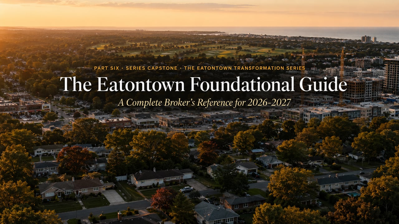
The Eatontown Foundational Guide 2026: A Monmouth County Broker’s Complete Reference for Buyers and Sellers
Anthony Licciardello
|
May 13, 2026
Eatontown,NJ
SHARE
The Eatontown Transformation Series
A six-part broker's field report from Monmouth County's most active redevelopment corridor.
Part 01
The Five Projects
Part 02
Tenant Tracker
Part 03
Officer Housing Resale
Part 04
Suneagles Story
Part 05
Eatontown vs. Holmdel
Part 06
Foundational Guide
Part Six · The Series Capstone
The Eatontown Foundational Guide: Everything a 2026-2027 Buyer or Seller Needs to Know About Monmouth County's Redevelopment Corridor.
Neighborhoods, schools, commute, demographics, redevelopment pipeline, cost of ownership, and what's worth paying premium for. The complete reference my clients consult before any Eatontown purchase decision — and the synthesis that closes the six-part series.
1670
Thomas Eaton Surveyed the Land
~13.5K
Current Population 5.92 sq mi area
4
Public Schools K-8 + Regional HS
$1.5B+
Redevelopment Capital 2026-2028 pipeline
This is the foundational reference my clients receive before any serious Eatontown purchase conversation. It synthesizes the five previous installments of this series into the canonical guide for a 2026-2027 buyer or seller approaching the corridor — covering everything from the neighborhood-level read to the school district structure to the commute infrastructure to the redevelopment pipeline timeline. Where deeper detail is helpful, I point to the relevant prior installment.
If you're new to this series and starting here, that is the right call. Read this guide first to get the lay of the land, then drill into any of the supporting installments. If you've followed the series from Part 1 through Part 5, this is the closer that brings it all together.
◆
01
Quick Navigation
What's in this guide and where to jump
Table of Contents
02
A Quick History
Thomas Eaton, the grist mill, the railroad, the Fort.
03
Demographics & Profile
Population, income, age, household composition.
04
Neighborhoods
Five distinct character areas and what each is known for.
05
Schools
The four-school structure and the Monmouth Regional pathway.
06
Commute Infrastructure
Little Silver train, GSP exits, Route 35, Route 36.
07
Redevelopment Pipeline
The 2026-2028 delivery timeline that's reshaping the corridor.
08
Cost of Ownership
Taxes, insurance, utilities, and what to actually budget.
09
Four Pillars
What's worth paying premium for — and what isn't.
◆
02
A Quick History
Thomas Eaton, the grist mill, the railroad, and the Fort
355 Years of Eatontown, in Four Beats
1670 · The Founding. Thomas Eaton, an early settler from Goodhurst, Kent, England, surveyed the area and built a grist mill in what is now Wampum Park on Route 35 (a historical marker erected by the Eatontown Historical Committee in 1970 commemorates the site). The land had been home to the Lenape people, and "Wampum" is a direct linguistic legacy from that period — referring to the shell beads the Lenape produced and used for ritual purposes and exchange. The town derives its name from Eaton's mill operation; the original Thomas Eaton died in 1688.
1796-1850 · The Village. A village developed across from Eaton's mill, anchored by a tannery, a general store, and a tavern at what is now the intersection of Main and Broad Streets, serving the New York-to-Philadelphia stage coach trade along the Red Bank Turnpike (today's Route 35). By 1850, the village had grown to four stores and roughly forty homes. The Eatontown Steamboat Company built docks on Oceanport Creek for milled flour and produce shipments to New York City.
1873 · Incorporation. Eatontown was incorporated as a township by the New Jersey Legislature, carved out of Ocean Township and Shrewsbury Township. Portions of the township were later taken to form West Long Branch (1908) and Oceanport (1920). On March 8, 1926, Eatontown was reincorporated as a borough — its current form of government.
1917-2011 · The Fort Monmouth Era. Camp Little Silver was established in June 1917 during the United States' early involvement in World War I as a temporary facility to train the 1st and 2nd Reserve Signal Battalions. Renamed Camp Alfred Vail in September 1917, then granted permanent status and renamed Fort Monmouth in August 1925, the installation reshaped Eatontown's economic identity for nearly a century — at its World War I peak the post housed approximately 10,000 military personnel, and over the decades the campus hosted significant civilian research and engineering operations spanning communications, electronics, and radar development. The Base Realignment and Closure (BRAC) process began in 2005, the final flag-lowering ceremony occurred September 10, 2010, and the formal closure was completed in 2011. The redevelopment of the 1,127-acre former installation under FMERA — spanning Eatontown (37%), Tinton Falls (40%), and Oceanport (23%) — is the foundation of the corridor story I've worked through across Parts 1-5 of this series.1
For the full Fort Monmouth redevelopment context, see Part 1. For the specific FMERA dispositions covering Suneagles and the former officer housing, see Part 3 and Part 4.
◆
03
Demographics
Who actually lives here, in numbers
The Eatontown Demographic Read
~13,500
Population (2023 Census Est.)
$90,463
Median Household Income (2024)
45.5
Median Age (Years)
5.92
Land Area (Square Miles)
58.1%
Homeownership Rate
22 min
Avg Commute (Drive-Alone)
2,295
Pop. Density per Sq Mile
~26%
Foreign-Born Residents
Racial composition: approximately 60% White (non-Hispanic), 15% Hispanic, 13% Asian, 7% Black, 5% two-or-more-races. Italian ancestry leads the historical-heritage breakdown at roughly 14% of residents, followed by Irish (6%), Portuguese (4%), English (3.5%), and Jamaican (3.5%) — reflecting the broader Monmouth County demographic pattern with a significant share of late 20th-century immigration from southern Europe and the Caribbean. A meaningful share of more recent Eatontown buyers come from NYC borough markets that supply many of these relocating buyers — particularly Staten Island households moving for school quality, lifestyle, and tax structure considerations.
Income structure: the household income distribution is bimodal — roughly 24% of households earn under $25,000 (often retirees, single seniors, and renters in older multifamily inventory), while another 24% earn over $150,000 (often dual-income professionals in detached single-family homes). The middle bands fill in the rest. Median household income is $90,463, modestly below Monmouth County's $124,845 median and roughly aligned with the New Jersey state median.
Housing stock: approximately 4,758 housing units total. About 50% detached single-family homes, 17% attached/townhouse, and the remainder in 2-to-4-unit and larger multifamily buildings, plus a small mobile-home share. The median construction year is 1974 — meaning most Eatontown housing was built during the post-World War II suburban expansion and the Fort Monmouth-era growth that followed.2
◆
04
Neighborhoods
Five distinct character areas inside 5.92 square miles
How the Town Actually Reads at Street Level
Eatontown is not a town of named historic enclaves the way Holmdel is (see Part 5). Its character is organized along five informal character areas that buyers and longtime residents recognize, each with a distinct lot pattern, housing era, and price band.
01 · The Historic Core
Main Street, Broad Street, Lewis Street
The original 1796 village center anchored at the intersection of Main and Broad Streets, where the New York-Philadelphia stage coach tavern once stood. Mostly tight grid blocks with smaller lots (typically 5,000-8,000 SF), older housing stock from the late 1800s through the 1920s, and direct walking access to the borough's civic core, downtown retail, and the Lewis Street rail crossing. The character here is more village-historic than suburban-modern.
02 · The Wampum Corridor
Wampum Park & Surrounding Streets
The geographic origin point of the borough, where Thomas Eaton built his grist mill in 1670. Now anchored by Wampum Park and the surrounding residential streets. Borough planning documents note recurring drainage and flooding challenges along the Wampum corridor that the township has been actively addressing through stormwater infrastructure investments. Larger lots than the historic core, with a mix of mid-century single-family and some newer construction.
03 · The Tinton Avenue Corridor / Pinebrook
North Side · Adjacent to Fort Monmouth
The northern Eatontown corridor along Tinton Avenue, sitting at the western entrance to the former Fort Monmouth Charles Wood area. Pinebrook is the residential subarea here, and the Pinebrook Housing parcel within the former Fort was an inactive officer-housing site for over a decade before its redevelopment was approved. This is also where Suneagles Golf Course and the new Ridge at Suneagles townhome community sit (covered in Part 4). The corridor is becoming the most architecturally interesting residential pocket of Eatontown, with $1.55M+ list pricing on new construction.
The mid-century commercial spine along Route 35 anchored historically by Monmouth Mall (now being redeveloped as Monmouth Square — see Part 2). Residential side streets surrounding Route 35 are mostly mid-century ranches, capes, and split-levels on suburban lots (8,000-12,000 SF). This is where the Livana Monmouth Square 1,000-unit rental community is going vertical and where Felice's first New Jersey flagship will operate. The corridor here will be unrecognizable by late 2027 compared to its 2024 state.
05 · Locust Grove & West Long Branch Border
The Eastern Edge of the Borough
The unincorporated community of Locust Grove, plus the broader eastern Eatontown corridor running toward the West Long Branch border. More suburban-spacious than the historic core, with mid-century housing on slightly larger lots and quieter residential streets. Several pockets of this area are within walking distance of Monmouth Park Racetrack, which adds a seasonal lifestyle dimension that buyers should factor in.
◆
05
Schools
Four schools, a sequential structure, and the Monmouth Regional pathway
The Eatontown School Structure Buyers Need to Understand
The structure is unusual. Unlike most New Jersey towns where each elementary school serves a defined neighborhood K-5, Eatontown operates a sequential grade-band structure: all PK-1 students attend one school, all 2-4 students attend another, all 5-6 students attend a third, and all 7-8 students attend the middle school. This means children move buildings every 1-3 years for the first nine grades of their education. Buyers with kids need to understand this before relocating.
Tier 01 · Earliest Years
Meadowbrook Elementary
Grades PK-1 · 235 students · Student-teacher ratio 11:1 · Niche overall grade B · 65 Wyckoff Road. Gifted & Talented program available.
Tier 02 · Lower Elementary
Woodmere Elementary
Grades 2-4 · 323 students · Student-teacher ratio 11:1 · Niche overall grade B · 65 Raleigh Court. Math proficiency 50-54%, reading proficiency 45-49%.
Tier 03 · Upper Elementary
Margaret L. Vetter Elementary
Grades 5-6 · 222 students · Student-teacher ratio 10:1 · Niche overall grade B+ · 3 Grant Avenue. Reading proficiency 60-64%, math proficiency 40-44%.
Tier 04 · Middle School
Memorial Middle School
Grades 7-8 · 178 students · Student-teacher ratio 7:1 · Niche overall grade B+ · 7 Grant Avenue. Reading proficiency 50-54%, math proficiency 35-39%.
High school: Monmouth Regional in Tinton Falls. Eatontown is a "sending district" for high school, meaning 9-12 students attend Monmouth Regional High School located in Tinton Falls, which also serves Tinton Falls and Shrewsbury Township students. Monmouth Regional is ranked #173 in NJ by Niche and #245 in NJ / #7,772 nationally by US News, with an 89% graduation rate and 33% AP participation. For the deeper school comparison versus Holmdel's K-12 unified district, see Part 5.
District context: the Eatontown Public Schools district is classified by the NJ Department of Education in District Factor Group "FG," the fourth-highest of eight socioeconomic groupings. Per-pupil spending is $25,554, which is above the New Jersey state average. The district enrolls 1,022 students with a 10.5:1 student-teacher ratio. Math proficiency averages 44% (vs. NJ average 38%) and reading proficiency 53% (vs. NJ average 49%). PublicSchoolReview ranks the district #274 of 645 NJ districts (top 50%) and notes that the district is in the top 1% of NJ districts for student diversity.3
◆
06
Commute Infrastructure
Train, parkway, and highway access
How Buyers Actually Get to and from Eatontown
NJ Transit Rail
Little Silver Station · ~3 miles
The closest NJT rail station to Eatontown. Service on the North Jersey Coast Line, operating from New York Penn Station to Bay Head. Direct service to NYC during peak hours; transfer at Long Branch for off-peak. The line is electrified through Long Branch and continues with diesel shuttle service further south. For buyers also weighing the rail-served towns north on the North Jersey Coast Line, the Aberdeen-Matawan corridor sits roughly 30 minutes closer to Penn Station with a different pricing dynamic.
Garden State Parkway
Exit 105 (Route 18 / Route 36)
The GSP is the primary north-south commuter spine. Exit 105 (the Eatontown Spur) connects to Route 18 (north to New Brunswick) and Route 36 (east to Long Branch and the Atlantic coast) and is the principal access point for Eatontown. The next northbound option for the western edge of the borough is Exit 117 in Tinton Falls. Northbound to Newark Airport runs roughly 50 minutes off-peak; to the Holland Tunnel about 70 minutes off-peak. Heavy traffic during peak hours adds 30-45 minutes.
Route 35 (Red Bank Turnpike)
The Commercial Spine
Runs north-south through the heart of Eatontown. The historic stagecoach route, now the primary commercial corridor anchored by Monmouth Square (former Monmouth Mall). Connects to Red Bank to the north and Asbury Park to the south. Route 35 is the road most buyers will think of as "the road through Eatontown."
Route 36 & Route 18
East-West Connectors
Route 36 runs east toward Long Branch and the Atlantic coast. Route 18 runs west toward New Brunswick and the Route 1 corridor. Both connect Eatontown to broader central Jersey infrastructure. For drivers commuting toward the Rutgers / Princeton corridor or to New Brunswick, Route 18 is the workhorse.
Ferry to Manhattan from Atlantic Highlands. For Manhattan commuters who want the most pleasant ride, the Seastreak ferry from Atlantic Highlands (about 20 minutes northeast of Eatontown by car) runs to Wall Street and Midtown several times daily during peak commute hours. Travel time is roughly 45-50 minutes one-way to Manhattan, with significantly better reliability than the train. Many Eatontown professionals working in finance use this option.
Average commute time for Eatontown residents: 22 minutes (Census ACS), with the vast majority driving alone. This is meaningfully shorter than the Holmdel average and reflects that most working Eatontown residents are not making the Manhattan trip daily — they're working in Monmouth County or the immediate central Jersey corridor.
◆
07
Redevelopment Pipeline
What's delivering when, and what's behind
The 2026-2028 Delivery Timeline
This is the synthesis of Part 1's $1.5B+ project flyover compressed into a single delivery calendar. Each entry corresponds to a deeper installment of this series where relevant. For context on how the Eatontown pipeline fits into the broader Monmouth County redevelopment landscape — including the Monmouth Park racetrack mixed-use plans, Middletown's West Nut Swamp townhomes, and Azura at Holmdel — the March 2026 Prodigy county overview puts each project in its full regional context.
Q4 2026
Monmouth Square Opens
Kushner's $500M mixed-use redevelopment opens with Whole Foods, Felice (SA Hospitality's first NJ flagship), the relocated Barnes & Noble, and the first phase of the Livana 1,000-unit apartment community. See Part 2 for the full tenant tracker.
2026-2027
Netflix Studio Construction
Construction continues on the Netflix studio campus on the Mega Parcel at Fort Monmouth, with operational phase targeted for 2027-2028. The largest single creative-industry capital investment in Monmouth County history.
January 2027
Suneagles Phase II Complete
Per FMERA's February 2026 4th Amendment, Ridge at Suneagles' Phase II completion is extended to January 21, 2027. Final residential build-out of the 60 luxury condominium townhomes and 15 affordable rental units. See Part 4.
2027-2028
Bell Works Fort Monmouth Activation
Inspired by Somerset Development's second "metroburb" at the former Fort Monmouth HQ building reaches full operational stage. Office, retail, and amenity tenants stand up in volume.
Howard Commons: the long-vacant Fort Monmouth housing parcel adjacent to the Pinebrook corridor was approved for redevelopment in 2022, with demolition of the dilapidated existing units and construction of a new housing community now in progress. Specific delivery timeline continues to evolve as project approvals advance.
East Gate at Oceanport: immediately adjacent to Eatontown on the Oceanport side, the East Gate community is approximately 90%+ sold-through on its 68 for-sale units. The resale market in this community has now produced multiple comps that anchor the broader corridor's appreciation thesis — see Part 3 for the verified resale data including a 4BR/3.5BA SFD that sold for $1,280,000 in May 2025 (a 70%+ appreciation from its 2018 launch pricing).
◆
08
Cost of Ownership
What to actually budget on a $700K-$1.2M property
The Annual Carrying Cost Math
Line Item
$700K Property
$1.2M Property
Annual Property Tax
2024 general rate 1.872 per $100
~$13,100
~$22,500
Homeowners Insurance
Typical NJ shore-zone range
~$1,800-$2,500
~$2,500-$3,800
Utilities (Avg)
Electric, gas, water, sewer
~$4,200-$5,400
~$5,400-$7,200
HOA (if applicable)
For townhome / condo product
$0-$3,500
$0-$5,800
TOTAL ANNUAL CARRY
Excluding mortgage P&I
~$19K-$25K
~$30K-$40K
Tax calculation uses the verified 2024 New Jersey Department of the Treasury Eatontown general tax rate of 1.872 per $100 of assessed value. Insurance ranges reflect typical NJ shore-region homeowners coverage for the listed price points. Utility ranges reflect typical Monmouth County household consumption. HOA ranges reflect commonly observed dues at the Ridge at Suneagles ($480/month) and other Eatontown townhome communities. All figures are typical ranges for budgeting purposes; verify final assessment, insurance quotes, and utility consumption with the specific property and provider before any purchase decision.
For most buyers, the property tax line is the largest single recurring expense after the mortgage payment itself. Eatontown's 2024 general tax rate of 1.872 per $100 of assessed value is among the higher rates in central Monmouth County, reflecting the township's school funding obligations, its share of the Monmouth Regional High School District levy, and its municipal services. Buyers should ALWAYS pull the prior year's actual tax bill for the specific property they're considering — assessed values can differ materially from market values, and prior-year bills are the truest indicator of what the new owner will actually pay. (For buyers comparing Eatontown's straightforward tax math against more complex NJ-specific mechanisms elsewhere on the corridor, Long Branch's PILOT mechanism explains how Pier Village condos can carry dramatically lower carrying costs than comparable neighboring properties — useful context for understanding why two seemingly similar listings can have very different annual costs.)
◆
09
The Four Pillars
What's worth paying premium for — and what isn't
A Broker's Synthesis — Where Premium Is Justified
If I had to compress the entire six-part series into four practical pillars for a 2026-2027 buyer entering Eatontown, here is what I would tell them.
Pillar 01
Pay premium for the Tinton Avenue / Pinebrook corridor and Ridge at Suneagles adjacency.
This is the corridor with the strongest forward-looking story. The Tillinghast course pedigree (1926, 6,357 yards, A.W. Tillinghast original design with Byron Nelson's 1935 first professional victory recorded on its history), the National Register Gibbs Hall, the new-construction luxury townhomes at the Ridge at Suneagles with verified comp data trending from $959K (2022) to $1.55M (2025 list), and the relative quiet of being slightly north of the Route 35 commercial spine make this the architecturally most interesting pocket of the borough. For empty-nesters and luxury buyers who want walkability-adjacent new construction with a historic golf pedigree, this is the answer.
Pillar 02
Don't pay full freight on the Route 35 commercial spine until Monmouth Square opens.
The Route 35 corridor and the residential streets surrounding the former Monmouth Mall site are in transition. Pricing in 2026 reflects construction-disruption discount for the area immediately surrounding the active Monmouth Square build. Once Whole Foods, Felice, and Livana go operational in Q4 2026 / 2027, the area's lifestyle premium should re-rate upward materially. Buyers patient enough to time the inflection should target this corridor for the biggest near-term value capture.
Pillar 03
Understand the school structure before relocating with children.
Eatontown's sequential elementary structure (PK-1, 2-4, 5-6, 7-8) means children move buildings frequently in their first nine grades. Combined with the Monmouth Regional High School pathway (ranked #173 in NJ Niche / #245 in NJ US News), this is a structurally different educational experience than buyers from Holmdel, Rumson, or Fair Haven will be expecting. For families prioritizing top-decile school outcomes, see Part 5 for the Holmdel comparison — that may be the right alternative. For a deeper look at the Holmdel precision-luxury market in detail — including Beau Ridge, Chestnut Ridge Estates, and the Holmdel Road estate corridor — the March 2026 segmented luxury breakdown explains how Holmdel's micro-markets price independently.
Pillar 04
Time the Netflix studio operational stage carefully.
The Netflix studio campus at the Mega Parcel reaches operational stage targeting 2027-2028. The corridor's residential pricing premium reflects forward-looking optimism right now — not yet operational impact. Buyers entering in 2026 are buying the thesis. Buyers entering in 2028 will be buying the proven reality. The risk and reward profile is materially different at those two entry points, and a thoughtful buyer should think about which one fits their hold horizon and risk tolerance.
Eatontown in 2026 is a corridor in motion. Six years from now, the streetscape around Monmouth Square, the new Bell Works at Fort Monmouth, and the Netflix studio campus will be unrecognizable from what 2024 buyers saw. The thesis of the whole series is simple: this is a corridor where the value of being informed dwarfs the value of being early. Read carefully, choose your pocket carefully, and buy thoughtfully.
— Anthony Licciardello · The Prodigy Team
Sources & Data Notes
1. Eatontown history (Thomas Eaton from Goodhurst, Kent, England, surveyed area and built grist mill in 1670 at site now commemorated by historical marker in Wampum Park on Route 35 erected by Eatontown Historical Committee in 1970; Eaton died 1688; village developed 1796 with general store, tannery, stagecoach tavern at Main and Broad Streets along Red Bank Turnpike now Route 35; by 1850 ~40 homes and 4 stores; Eatontown Steamboat Company built docks on Oceanport Creek; incorporated as Eatontown Township April 4, 1873 by NJ Legislature; reincorporated as borough March 8, 1926; portions later carved off to form West Long Branch (April 7, 1908) and Oceanport (April 6, 1920); total area 5.92 sq mi / 15.13 sq km land + 0.13 sq km water; borders Oceanport NE, Ocean Twp S, Shrewsbury N, Tinton Falls W, West Long Branch E; Camp Little Silver established June 1917, renamed Camp Alfred Vail in September 1917, redesignated Fort Monmouth in August 1925 in honor of soldiers who died in the 1778 Battle of Monmouth; final flag-lowering ceremony at Fort Monmouth occurred September 10, 2010 with formal BRAC closure completed 2011; total 1,127-acre installation spans Tinton Falls 40%, Eatontown 37%, and Oceanport 23%; FMERA established to redevelop former installation): Wikipedia, Eatontown New Jersey; Monmouth Timeline (U.S. Army Signal Corps Arrives In Little Silver To Begin Construction Of Fort Monmouth); U.S. Army CECOM Historian Office (Fort Monmouth: From Signal to CECOM LCMC); Eatontown Grist Mill historical marker (HMDB.org); WorldAtlas; Borough of Eatontown official site; FMERA site materials.
2. Eatontown demographics (2020 Census official population 13,597; 2023 Census Bureau Population Estimate approximately 13,496; 2025 projected population 13,412 per CUBIT; median household income $90,463 in 2024 (Census ACS 5-year); per capita income $50,005; median age 45.5; 5,720 households; median home value $492,400-$547,644 depending on source methodology; zip 07724 median home value $522,100; homeownership rate 58.1%; foreign-born approximately 26%; racial composition ~60% White non-Hispanic, ~15% Hispanic, ~13% Asian, ~7% Black; Italian ancestry 14% largest heritage group; cost of living index 119.1; land area 5.92 sq mi; population density 2,088-2,295 per sq mi; average commute time 22 minutes; average 2 cars per household; 4,758 housing units total with ~50% detached SFH, ~17% attached/townhouse; median construction year 1974): U.S. Census Bureau QuickFacts; Census Reporter ACS 2024 5-year estimates; Data USA Eatontown NJ; CUBIT New Jersey Demographics; Point2Homes Eatontown demographics; City-Data Eatontown NJ.
3. Eatontown Public Schools structure (PK-8 district with 4 schools and 1,022 students total per 2024-25 enrollment; sequential grade structure: Meadowbrook Elementary PK-1 / 235 students / 65 Wyckoff Road, Woodmere Elementary 2-4 / 323 students / 65 Raleigh Court, Margaret L. Vetter Elementary 5-6 / 222 students / 3 Grant Avenue, Memorial Middle School 7-8 / 178 students / 7 Grant Avenue; high school students attend Monmouth Regional High School District in Tinton Falls which also serves Tinton Falls and Shrewsbury Township; NJ Department of Education District Factor Group "FG" fourth-highest of eight; per-pupil spending $25,554; PublicSchoolReview district rank #274 of 645 NJ districts; math proficiency 44% / reading proficiency 53%; minority enrollment 57-60%; economically disadvantaged 43.4%; district in top 1% of NJ districts for diversity; Niche district grade B+/B; student-teacher ratio 10.5:1): Eatontown Public Schools official site; Wikipedia, Eatontown Public Schools; PublicSchoolReview Eatontown Public School District; Niche.com 2026 rankings; U.S. News & World Report 2025 Best High Schools; National Center for Education Statistics.
Tax figures cited reflect verified 2024 New Jersey Department of the Treasury General Tax Rates. 2025 final certified rates should be re-verified against the Monmouth County 2025 Final Tax Rate Table at the time of any purchase decision. Cost-of-ownership ranges are general market commentary for budgeting purposes; verify final assessment, insurance quotes, and utility consumption with the specific property and provider before any purchase decision. School rankings reflect publicly available data through the 2026 Niche rankings cycle and the 2025 U.S. News Best High Schools cycle. This Foundational Guide is broker market commentary and is not a substitute for licensed real estate counsel or personalized financial advice. Prospective buyers should consult licensed New Jersey real estate counsel before any purchase decision.
Frequently Asked Questions
Question
Is Eatontown, NJ a good place to live in 2026?
Eatontown is one of the most active redevelopment corridors in Monmouth County in 2026, with over $1.5 billion in capital being deployed across Monmouth Square (the former Monmouth Mall site), the Netflix studio campus at the Mega Parcel of Fort Monmouth, Bell Works Fort Monmouth, the Ridge at Suneagles townhome community, and the East Gate at Oceanport on the adjacent border. The borough offers a 22-minute average commute, an FG District Factor Group public school system with $25,554 per-pupil spending, and a 58.1% homeownership rate. It is a particularly strong fit for relocating creative professionals working with Netflix at Fort Monmouth, empty-nesters wanting walkability and new-construction product, and first-time buyers seeking a lower entry price than Holmdel or the Two Rivers towns. Families prioritizing top-decile school outcomes may want to compare against Holmdel — see the Eatontown vs. Holmdel comparison post for the side-by-side analysis.
Question
How does the Eatontown school district work?
The Eatontown Public Schools district is unusual in that it operates a sequential grade-band structure rather than neighborhood-zoned elementary schools. All PK-1 students attend Meadowbrook Elementary (235 students at 65 Wyckoff Road). All 2-4 students attend Woodmere Elementary (323 students at 65 Raleigh Court). All 5-6 students attend Margaret L. Vetter Elementary (222 students at 3 Grant Avenue). All 7-8 students attend Memorial Middle School (178 students at 7 Grant Avenue). High school students attend Monmouth Regional High School located in Tinton Falls. This means Eatontown students move buildings frequently in their first nine years of education. The district is classified by the NJ Department of Education in District Factor Group "FG," with $25,554 per-pupil spending and a 10.5:1 student-teacher ratio.
Question
What is the closest train station to Eatontown, NJ?
The closest NJ Transit rail station to Eatontown is Little Silver Station, approximately 3 miles north of the borough. Little Silver is served by trains on NJ Transit's North Jersey Coast Line, with service from New York Penn Station to Bay Head. Direct service to NYC is available during peak commute hours; off-peak service typically requires a transfer at Long Branch. The line is electrified through Long Branch and continues with diesel shuttle service to Bay Head. For Manhattan commuters, the Seastreak ferry from Atlantic Highlands (approximately 20 minutes northeast of Eatontown by car) offers a 45-50 minute one-way ride to Wall Street or Midtown with significantly better reliability than the train.
Question
What is the property tax rate in Eatontown, NJ?
Per the New Jersey Department of the Treasury 2024 General Tax Rates, Eatontown Borough's general tax rate is 1.872 per $100 of assessed value (effective tax rate 1.663). On a $700,000 property this represents approximately $13,100 in annual property tax; on a $1,200,000 property approximately $22,500. Eatontown's general rate is approximately 15.8 percent higher than Holmdel's 1.576 rate and reflects the borough's school funding obligations, its share of the Monmouth Regional High School District levy, and its municipal services. 2025 final certified rates should be verified directly with the Monmouth County Tax Board at the time of any purchase decision, as final rates can shift modestly year over year. Buyers should always pull the prior year's actual tax bill for the specific property they are considering to confirm carrying cost projections.
The Eatontown Transformation Series
Series Complete · Six Posts Covering $1.5B+ of Monmouth County Redevelopment
Thank you for reading. The complete six-part Eatontown Transformation Series is now live. For continuing coverage of the corridor — resale comp updates, tenant signings, and the next round of FMERA dispositions — subscribe to the Prodigy Real Estate market reports newsletter.
20+ years and 5,000+ closed transactions across New Jersey and Staten Island, with active broker presence across the Two Rivers, Eatontown, Fort Monmouth, and Holmdel corridors. Posted May 10, 2026.
Work With Us
Prodigy Real Estate is an innovative real estate company offering high-end video production, home valuation services, purchasing, and home sales. Serving New York and New Jersey.
Prodigy Real Estate Innovative real estate company that provides the most advanced marketing for today's climate. Based in Staten Island, NY and serving the New York Metro area.