
Anthony Licciardello | April 26, 2026
Westfield, NJ
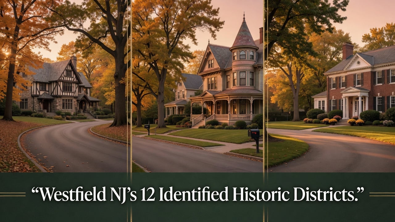

Most of the homes Westfielders think of as "historic" sit inside neighborhoods the Town has formally identified as historically significant — but that haven't been legally protected. Wychwood, Boulevard, Dudley Park, Stoneleigh Park, Westfield Gardens, Tremont Avenue, Prospect Street, the Downtown commercial core, Brightwood Park, the Presbyterian Church grounds, the Forest/Glen Tudor Revival pocket, and a cluster of newer Connolly & Hickey-identified neighborhoods. Twelve districts in total, hundreds of properties, and exactly zero of them are subject to mandatory Historic Preservation Commission review.
This is a district-by-district guide to every one of those 12 — what makes them historically significant, where the boundaries currently sit, which already contain locally designated individual landmarks, and what the 2024 Historic Preservation Master Plan Element recommends for each. For the catalog of Westfield's 26 individually designated historic landmarks, see our complete guide to Westfield's designated landmarks.
The Distinction That Matters
01
Kimball Avenue is the only locally designated historic district in Westfield. Designated by ordinance in 1995, its 15 properties are subject to Historic Preservation Commission review for any exterior alterations, additions, or demolitions. Every other "historic district" you'll see referenced on Town maps, in Master Plan documents, or in real estate listings is identified rather than designated. The difference is binding versus advisory. Identification documents historical significance and recommends a property or area for future study. Designation places it under the jurisdiction of the HPC and triggers the Certificate of Appropriateness review process.
The 2024 Historic Preservation Master Plan Element — the Town's current authoritative preservation document, adopted by the Planning Board on April 1, 2024 — identifies 12 districts that meet the documentation threshold for further study and possible designation. Some of these districts already contain individually designated landmark homes scattered within their boundaries. None of them carry district-wide HPC review authority. The Plan's central recommendation is to change that, beginning with smaller cohesive enclaves like Stoneleigh Park.
Closest to Designation
02
Stoneleigh Park is the district closest to formal local designation in Westfield, and the 2024 Master Plan Element specifically identifies it as the priority candidate. The neighborhood was developed as an early-20th-century planned residential community of approximately 30 single-family houses on roughly 20 acres of parklike property, with 29 of the houses arranged on a looped drive that runs diagonally across the park. The Stoneleigh Park Historic District was listed on the State and National Registers in 1998 — the only Westfield district to carry that level of designation.
The houses inside the district fall into three architectural waves. Group 1 (1904–1914) consists of variations of the early Colonial Revival style and contains all but one of the key contributing buildings. Group 2 (circa 1920s) introduces English Tudor influences. Group 3 (circa 1941–1959) brings mid-century contemporary styles and contains four properties the National Register nomination describes as "generally non-contributing." Four homes within the district have been locally designated as individual landmarks and are profiled in the Westfield landmarks guide.
The case for moving Stoneleigh Park to local designation is, in part, built on what's already been lost. The 2024 Plan documents that since the 1998 State and National Register listing, four properties within the district have been altered (including three contributing buildings at 8, 9, and 15 Stoneleigh Park, and one key contributing building at 17 Stoneleigh Park), and one non-contributing property at 10 Stoneleigh Park has been demolished and replaced with a new residence. State and National Register status, by itself, does not restrict privately funded actions. Local designation would.
The Woodland Enclave
03
Wychwood is the most architecturally distinctive of Westfield's identified districts and one of the most sought-after addresses in town. The development was created by Arthur Rule, who designed it as a suburban community of tree-lined curvilinear streets, larger-than-typical property lots, and an intentional absence of curbing and sidewalks — all features that survive today and define the neighborhood's character. The 1931 Wychwood sales book, published to promote the development, remains the boundary-defining historical document for which homes were part of the original Rule plan.
The 2024 Master Plan Element describes Wychwood's signature as an "eclectic mix of Old English architecture" and notes that the district is threatened by alterations made by individual homeowners — alterations that, in the absence of local designation, do not require HPC review. The Plan specifically prioritizes Wychwood for further research to define current boundaries based on which original Rule-era properties retain integrity. The district contains the locally designated Ball-Platt / Joseph Ball / Amzi Ball House at 526 Wychwood Road, profiled in the landmarks guide.
Two Eras of Affluence
04
The Boulevard was originally laid out as "Boulevard Ripley" in 1872 by Chauncey B. Ripley — a teacher, lawyer, and the principal developer of the section of Westfield south of the railroad tracks between 1866 and 1896. Ripley filed his map in 1872 between South Avenue and the Clark line; after the depression of the mid-1870s slowed work, his estate continued land acquisitions through 1901. The "Ripley" name was dropped around 1900, and what remained became one of the most carefully composed residential streets in suburban New Jersey.
The Boulevard Historic District as identified by the 2024 Master Plan Element comprises two distinct development eras. The 500 block was developed in the 1880s and 1890s with primarily Queen Anne-style houses; this stretch succeeded Westfield Avenue and preceded Dudley Avenue as the most affluent address in town. The 600 block was developed largely between 1900 and 1915 in the upper-middle-class revival styles that defined the era. Several Park Street properties are also included within the district boundaries.
The most notable structure in the district is the Squires Clubhouse at 545 Boulevard, an 1890 Federal Revival house with a semi-circular entrance portico. Originally built as the residence of Charles N. Codding, a county and municipal Republican leader and prominent attorney, the home was remodeled along Federal Revival lines in the early 1920s by architect Charles Darsh, a disciple of Stanford White, who also remodeled No. 546 and resided at No. 534. Other notable Boulevard properties include numbers 503, 509, and 515 — fine Queen Anne examples — with No. 515 being the early residence of Henry C. Sergeant, a founder of Ingersoll Rand. A 1906 Queen Anne/Romanesque house at 317 Park Street, with a round Romanesque tower and conical roof, anchors the Park Street portion of the district. The 2024 Plan recommends extending the proposed district boundaries south of Washington Street.
The Railroad Suburb's First Wave
05
Dudley Park traces its origins to 1864–1866, when John Q. and Helen M. Dudley purchased approximately 70 acres of land roughly centered on what is now Dudley Avenue. A development plan for "Dudley Park" was filed in 1869 with lots offered at 25-foot frontage for investment and development. The depression of 1873 slowed initial construction, but development resumed in 1885. In 1892 the Northside Railroad Station was built and the Central Railroad of New Jersey launched a publicity campaign to draw New Yorkers to Westfield — a campaign whose success drove the construction wave that defines the district today.
The Dudley Park Historic District as identified by the 2024 Plan was primarily developed from the 1880s through the 1920s and is described as a fine collection of late-19th and early-20th-century homes that illustrate the variations of turn-of-the-century architectural styles characterizing Westfield's emergence as a prestigious suburban railroad commuter community. The boundaries proposed in the 1986 Union County Historic Sites Inventory closely align with the original Dudley Park subdivision plan. The 2024 Plan recommends a resurvey to evaluate either a separate West Dudley Park Historic District or an extension of current boundaries west to encompass Clark Memorial Park.
Three locally designated landmarks already exist on West Dudley Avenue at 218, 248, and 266 W. Dudley Avenue (all on Block 903) — the densest contiguous run of designated private residences in Westfield outside Stoneleigh Park, profiled in the landmarks guide.
The Oldest Streetscape
06
Prospect Street is described in the 2024 Master Plan Element as "one of Westfield's oldest remaining neighborhoods." Along with Westfield Avenue, Prospect Street was one of the first two residential avenues leading away from the village center to be developed. Where Westfield Avenue has lost most of its historic integrity to infill and nonconforming additions, Prospect Street retains a substantial measure of the architectural flavor of Westfield's 19th-century transition from farming center to suburb.
The district's two main development eras are clearly defined. The 300–400 block, between Cowperthwaite Place and Dudley Avenue, was developed primarily between 1870 and 1890. The 200 block followed between 1900 and 1910, with the south side characterized by transitional Queen Anne and Colonial Revival houses. Most homes within the district were built between 1865 and 1910.
Four of the five oldest documented houses on Prospect Street still stand and are included within the proposed district boundaries: the 1861 Peek-Losee House at 212 Prospect Street, the old Pierson farmhouse at 311 Prospect Street, the Frank Ham House at 317 Prospect Street, and the 1870 Burhans House at 417 Prospect Street — the Burhans House having been individually locally designated and profiled in the landmarks guide. The locally designated Mills-Ferris-Pearsall House at 112 Ferris Place also sits within the district. The 2024 Plan recommends boundary reexamination prior to designation, particularly the eastern boundary, given recent redevelopment activity affecting Ferris Place.
The Commercial Core
07
The Downtown Historic District is the only identified district in Westfield with a National Register nomination actively in process. A potential downtown historic district was identified in the 2002 Master Plan and by the HPC in 1991, and the State Historic Preservation Office determined the Westfield Commercial Historic District eligible for National Register listing in 1999. In 2022, Connolly & Hickey conducted a preliminary architectural survey with updated boundary descriptions. An intensive-level architectural survey of Westfield's business district is currently underway, and a National Register nomination is being prepared with funding support from the New Jersey Historic Trust.
The downtown core's anchor structures span the late-19th and early-20th centuries. Arcanum Hall at 201 East Broad Street is an 1894 Queen Anne commercial building. The Welch Paint Store at 214 East Broad Street is an 1870s Second Empire clapboard structure. The Elmer E. Love Store at 109 East Broad Street is an 1890 Richardsonian Romanesque building. The north side of Broad Street between Elm and Prospect — built mostly during the 1890s — is the most architecturally cohesive segment of the district. Other notable buildings within the boundaries include the circa-1890 Etta Hall (now Bovella's Bakery) at Broad and Prospect, the old Westfield Theater at 112 Elm, the 1930s Rialto Theater, the Romanesque storefronts at 109 Broad and 55 Elm, the 1912 Schaefer's Department Store at 76 Elm, the former Traynor Building at 84 Elm, and 214 and 218 Broad — the last two being 1870 frame structures and the only remaining wood-frame buildings in downtown Westfield.
Three locally designated individual landmarks sit within or adjacent to the district: the Westfield Fire Headquarters at 401–405 North Avenue West, the South Avenue Train Station Coffee Kiosk, and the World War I Monument at the Plaza — all profiled in the landmarks guide. The Northside Railroad Station, an 1891–1892 Richardsonian Romanesque structure, was determined eligible for State and National Register listing in 1999 and is recommended by the 2024 Plan for future local designation.
The Other Identified Districts
08
The remaining identified districts span Westfield's 1900s residential expansion and reflect the Town's most recent surveying efforts. Each is documented in the 2024 Master Plan Element with varying levels of historical detail. The table below summarizes the era, dominant style, and current designation status for each.
| District | Primary Era | Dominant Character |
|---|---|---|
| Westfield Gardens | 1909–1940s | Colonial Revival, Spanish Colonial, Tudor, Norman |
| Tremont Avenue | Early 20th century | Early Colonial Revival streetscape (Terrace Park) |
| Brightwood Park | 1930s–1940s | Colonial Revival residential pocket |
| Presbyterian Church | 1720 forward | Burial ground + 1861–62 church (combined district proposed) |
| Forest / Glen Avenues | Early 20th century | Tudor Revival concentration |
| Connolly & Hickey emerging districts | Various | Stanley Oval, Dorian/Shadowlawn, Downer/W. Broad/First/Rahway/Osborne |
Identified in the 2002 Master Plan and reaffirmed in the 2024 Plan, Westfield Gardens was developed primarily between 1909 and the 1940s with the heaviest construction activity in the 1920s and 1930s. The district demonstrates a pleasing variety of styles within the Colonial Revival motif, with residences built around 1909 on Mountain Avenue and Highland Avenue showing Spanish Colonial Revival, Tudor, and a variation of the Prairie School. Beginning in 1926, developer Alfred H. Welch built two extensions of the Gardens that include what the 2024 Plan describes as the most distinguished collection of Tudor and Norman-style homes in Westfield and some of the finest of these styles in Union County. The Plan recommends boundary reexamination prior to local designation given alterations and new construction since 2002.
Identified by the 2002 Master Plan as one of the purest and best-preserved early Colonial Revival streetscapes in Westfield. Tremont Avenue is part of the larger Terrace Park development, which spanned South Euclid, Tremont, and Lenox avenues. The 2024 Plan recommends preliminary survey work to confirm continued integrity and to consider extending the proposed boundaries to align with the original Terrace Park development.
First identified in 2021 by the historic architecture firm Connolly & Hickey. The proposed district includes properties on Woodmere Drive, Sunnywood Drive, Fair Hill Drive, and Fairhill Road and features Colonial Revival homes constructed in the 1930s and 1940s — immediately after Westfield's greatest growth period of 1920–1930. The site of Brightwood Park itself, prior to its development as parkland, was historically home to a community of African Americans, and the 2024 Plan recommends further research to identify boundaries and significant sites in this connection.
The 2024 Plan recommends establishing a single combined district encompassing the locally designated Burial Ground of the Presbyterian Church at 125 Mountain Avenue (which dates to 1720 and is also on State and National Registers) and the adjacent Presbyterian Church at 315 East Broad Street (built 1861–1862, currently undesignated). The burial ground contains the graves of founders, original settlers, and Revolutionary War soldiers from Westfield and surrounding communities. The church played a role in the Revolutionary War when Westfield served as a command post at different times for the New Jersey Militia and the Continental Army. In the 1950s and 1960s, the congregation was the largest Presbyterian congregation in New Jersey, the largest east of the Mississippi, and the third largest in the United States.
Identified through community feedback during the 2023 public workshops for the 2024 Plan. The proposed district encompasses properties along Forest and Glen avenues between Edgewood and Longfellow avenues, with the highest concentration of early-20th-century Tudor Revival residences along Forest Avenue. The streetscape is defined by granite and granite-block curbing, consistent setbacks, and similar massing across the houses — the kind of cohesive rhythm the 2024 Plan identifies as warranting protection through formal designation.
In their 2021 Historic Preservation Element Update: Base Work, Part I report, Connolly & Hickey identified four additional potential historic districts beyond Brightwood Park: Stanley Oval, parts of Dorian Road and Shadowlawn Drive, and portions of Downer Street, West Broad Street, First Street, Rahway Avenue, and Osborne Avenue. The Downer/West Broad/First/Rahway/Osborne corridor was historically home to Westfield's African American and immigrant communities, and the 2024 Plan recommends further survey work to define district boundaries and identify sites of significance — potentially including the Langston Hughes house at 514 Downer Street, the Zora Neale Hurston residence at 405 West Broad Street, and the childhood home of Virginia Apgar at 549 Carleton Road, all flagged in the 2024 Plan as candidates for future individual landmark designation.
A Cautionary Note
09
The 2002 Master Plan identified a Harding Street California Bungalow Historic District. The proposed district consisted of nine residences — eight Mission-style bungalows and one additional house of similar massing in a different style — constructed in the 1920s in an architectural style not typical to the Northeast. By the time of the 2024 Master Plan Element review, the majority of these houses had been altered such that they no longer reflected their original Mission-style features, or had been demolished outright. The 2024 Plan formally removed the Harding Street California Bungalow Historic District from its list of recommended designations and concluded the district no longer retains the integrity required for designation.
For owners of properties currently inside one of the 12 identified districts — and for buyers evaluating homes that listing materials describe as "in a historic district" — the practical implication is twofold. First, your obligations are unchanged from any other Westfield property: no Certificate of Appropriateness is required, and renovation proceeds under standard permitting. Second, that status is provisional. If the 2024 Plan's central recommendation is implemented and additional districts move to formal local designation, the Stoneleigh Park, Wychwood, Dudley Park, Downtown, or Boulevard districts could shift from advisory to binding within the next several years. For broader market context, see our 2026 Westfield real estate market update and the actual costs of selling a home in Westfield.
Town of Westfield Historic Preservation Master Plan Element (adopted April 1, 2024; H2M Associates and Easton Architects, prepared with funding from the New Jersey Historic Trust). Town of Westfield 2002 Historic Preservation Master Plan Element. Connolly & Hickey Historic Preservation Element Update: Base Work, Part I report (2021). Union County Historic Sites Inventory: Westfield Town (1986, Janet Foster and John Patton Graham). Town of Westfield Historic Preservation Map (rev. February 25, 2025). Westfield Historical Society. Westfield Historic Preservation Commission ordinance documentation.
FAQ
How many historic districts are there in Westfield NJ?
Westfield has one locally designated historic district — Kimball Avenue, designated in 1995. The 2024 Historic Preservation Master Plan Element identifies 12 additional historic districts that have been documented in past survey efforts but are not legally protected. Of those 12, only Stoneleigh Park is currently listed on the State and National Registers of Historic Places.
Is my home in a Westfield historic district?
If your home is on Kimball Avenue or in the two-block segment that comprises the designated district, yes — and your exterior alterations require HPC review. If your home is inside one of the 12 identified districts (Wychwood, Boulevard, Dudley Park, Stoneleigh Park, Westfield Gardens, Tremont Avenue, Prospect Street, Downtown, Brightwood Park, Presbyterian Church, the Forest/Glen Tudor Revival pocket, or one of the Connolly & Hickey emerging districts), it is identified but not designated, and standard permitting applies. If your home is one of Westfield's 26 individually designated landmarks, HPC review applies regardless of district status.
Can the Town designate my Westfield neighborhood as a historic district without my consent?
Property owners have a formal protest petition mechanism. If a petition is signed by owners of 20 percent or more of the area within the proposed district, or of the lots extending 200 feet in all directions from the proposed designation, designation requires a two-thirds vote of the Town Council rather than a simple majority. The 2024 Plan also notes that designation of individual private properties is typically not pursued if the owner objects.
Which Westfield district is most likely to be designated next?
The 2024 Master Plan Element specifically prioritizes Stoneleigh Park for local designation. The district is already on the State and National Registers (1998), already contains four locally designated landmark homes, and has experienced documented integrity loss since 1998 — including alterations to four contributing or key contributing properties and one demolition. Local designation would give the HPC the review authority needed to prevent further loss.
Prodigy Real Estate is an innovative real estate company offering high-end video production, home valuation services, purchasing, and home sales. Serving New York and New Jersey.