
Anthony Licciardello | April 29, 2026
Westfield, NJ
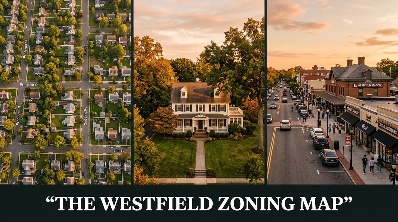

Almost every conversation about a Westfield home — what it can be expanded to, what the neighbor can build, how the property tax line item compares to the next town over, why one block trades at a different price per square foot than the block two streets up — comes back to a single document most homeowners have never opened. The Westfield Zoning Map. The current version is maintained by the Westfield Engineering Department; the original framework was drawn up in 1998 by the planning consultants Robert Catlin and Associates and adopted by Town Council that September. Almost three decades and several major amendments later, that framework still defines what every parcel in town is allowed to do.
The map is a black-and-white grid covered in codes — RS-40, RS-12, RM-6, RA-3, GB-2, NA-AH. Each one means something specific. The number after the letters is, in most cases, the minimum lot size in thousands of square feet. The first letter tells you the use category. The combination determines what can be built, where it can be built, how big it can be, and how far it has to sit from the property line. This is the buyer's, seller's, and homeowner's guide to reading that map and understanding what your zone actually allows in 2026.
Before getting into the codes, a piece of context. Our Above the Streets Westfield episode walks through how the town's design choices — the rail-first downtown, the preserved street grid, the careful infill — created the zoning environment that exists today.
The Code System 01
The Westfield zoning map uses a four-letter family code. RS means residential single-family. RM means residential multi-family at a low scale, generally single-family or two-family on a single lot. RA means residential apartment, the larger multi-family districts. GB means general business, CBD is the central business district, P is professional office, and O is the office district family. Newer codes adopted since 1998 — NA-AH, NS-AMFH, WBS-AMFH, and the AHO overlay districts — sit on the original framework and add affordable housing capacity near the train station.*
The number after the letters tells you the minimum lot area in thousands of square feet. RS-40 requires a minimum of 40,000 square feet — close to a full acre. RS-6 requires 6,000 square feet, the smallest single-family standard in town. RM-8 requires 8,000 square feet for a two-family dwelling. The math is consistent across the residential families and once you know the formula, every code on the map becomes legible at a glance.
Single-Family 02
Seven RS districts cover the bulk of Westfield's residential land. They run from the largest lots along the northern Mountainside border down to the densest single-family streets near the downtown core and along the Clark border to the south. Reading the map north to south, the lot sizes generally step down as you approach the train station and step back up again as you move into the southern interior.
| Zone | Min. Lot Area | Min. Lot Width | General Location |
|---|---|---|---|
| RS-40 | 40,000 sf | — | Northern edge near Echo Lake and the Mountainside border |
| RS-24 | 24,000 sf | — | Larger-lot interior bands; pockets along the southern Clark border |
| RS-16 | 16,000 sf | — | North-side estate streets and the eastern edge near the Cranford border |
| RS-12 | 12,000 sf | 75 ft (80 ft corner) | Established middle-density neighborhoods across most of central Westfield |
| RS-10 | 10,000 sf | — | Bridge between the larger inner districts and the smaller-lot grids closer to downtown |
| RS-8 | 8,000 sf | — | Older grid streets approaching the downtown core |
| RS-6 | 6,000 sf | — | Densest single-family grids near the CBD and along the southern border |
A pattern worth noting: all seven RS districts permit only single-family detached dwellings as principal uses. Two-family conversions are not permitted in any RS zone. That distinction — single-family detached only — is what preserves the residential character that defines Westfield's interior neighborhoods. Buyers who want a two-family or duplex must look at RM zones (covered in the next section) or specific multi-family RA zones.
Two-Family 03
Four RM districts cover the streets where two-family residential is allowed by right under specific lot standards. These zones cluster near the central business district and along the older grid streets close to the train station — the parts of Westfield platted earliest, where the street grid was tighter from the start.
| Zone | Single-Family Min | Two-Family Min | Notes |
|---|---|---|---|
| RM-12 | 12,000 sf | 12,000 sf | Lower-density two-family zones; larger lots required than RM-6 or RM-8 |
| RM-8 | 8,000 sf | 8,000 sf | Two-family must have appearance of single-family with one main entrance |
| RM-6 | 6,000 sf | 8,000 sf | Most common Westfield two-family zone; tighter lots near the downtown |
| RM-6D | 6,000 sf | 8,000 sf | Permits attached duplexes — two separate dwellings on two separate lots, sharing a common wall (4,000 sf each) |
RM-6D is the most distinctive of the four. It is the only Westfield zone that permits attached single-family duplexes — two homes sharing a common vertical wall, sitting on two separate lots of 4,000 square feet each. The architecture looks like a townhouse pair from the street, but each unit is owned independently with its own lot. RM-6D parcels are uncommon and concentrated in specific pockets on the map.
Investors looking for two-family inventory in Westfield work almost exclusively in RM-6 and RM-8. The two-family minimum lot of 8,000 square feet is the practical filter. A parcel of less than 8,000 square feet in either zone cannot be redeveloped as a two-family by right and would require a variance — a process the Zoning Board of Adjustment treats with case-by-case scrutiny.
Multi-Family 04
The RA family contains Westfield's higher-density residential zones. RA-1 sits on a one-acre minimum and is reserved for elderly housing. RA-2 requires two acres and was historically the garden apartment district along select inland nodes. RA-3 permits garden apartments and multi-family on 15,000 square feet, single-family on 6,000 square feet, and two-family on 8,000 square feet — making it one of the most flexible districts on the map. RA-4 requires five acres and is dedicated to senior housing. RA-5A and RA-5B are larger-acreage districts (five acres and two acres respectively) for specific multi-family contexts.
RA-5C is one of the newer additions to the map — a 60,000-square-foot minimum district adopted to support specific multi-family projects after the original ordinance. It does not appear on the 1998 map but sits in the current Article 11 Schedule of Zone Districts. The RA zones are concentrated along North Avenue, South Avenue, and a few inland corridors, which is why the train station ring has consistently been the location for higher-density housing in town.
Commercial 05
Commercial Westfield is contained in three families. The Central Business District (CBD) covers the historic downtown core — the streets around East Broad, Elm, Quimby, and the train station. The General Business (GB-1, GB-2, GB-3) districts extend along the secondary commercial frontages: GB-1 picks up neighborhood-scale commercial, GB-2 handles the broader corridors along North Avenue and South Avenue, and GB-3 is a smaller subset along specific frontages.
The C district is a small commercial node east of downtown. P-1 and P-2 are professional office districts that historically housed medical and legal practices in single-use buildings. O-1, O-2, and O-3 are the office district family — O-2 captures the corridor along the Mountainside-side approach, and O-3 sits along the Clark border at the southern edge of town.
The most consequential change in this commercial framework since 1998 is not a new district but a redevelopment plan. The South Avenue Redevelopment Plan, adopted by General Ordinance Number 2208 on March 9, 2021, governs specific parcels along South Avenue and supersedes underlying zoning for those properties. Redevelopment plans operate as a parallel framework to standard zoning — they apply to specifically designated parcels, contain their own bulk and use standards, and are administered by the Planning Board the same way zoning amendments are. South Avenue is the clearest current example.
The Newest Districts 06
The 1998 map remains the foundation, but it is no longer the whole picture. Several new districts have been added since to satisfy successive rounds of New Jersey Mount Laurel affordable housing obligations. These additions sit almost entirely within a half-mile of the train station and are designed to concentrate density where transit access already exists.
Three full transit-oriented development districts have been added that replace the underlying zoning on specific parcels: NA-AH (North Avenue Affordable Housing), NS-AMFH (New Street Affordable Multi-Family Housing), and WBS-AMFH (West Broad Street Affordable Multi-Family Housing). All three permit multi-family residential at higher densities with mandatory affordable set-asides. NA-AH and NS-AMFH are now formally listed as residential zone districts in the town's definitions.
Seven additional Affordable Housing Overlay (AHO) districts sit on top of existing commercial zoning without replacing it: GB1-AHO, GB2-AHO, GB3-AHO, C-AHO, SW-AHO, PA-AHO, and RP-AHO. The overlay framework is what we covered in detail in our analysis of Westfield's affordable housing overlay zones and the 380-unit obligation. None of these existed on the 1998 map. All of them are part of the current zoning framework.
Setbacks & Yards 07
Lot size is the headline number; yard setbacks are the standards that actually catch homeowners off guard. The Westfield Land Use Ordinance requires every lot to provide front, rear, and side yards according to the standards of its zone district. The required yard dimensions are measured perpendicular to the lot line, from the lot line to the furthest projection of the building. Eaves and cornices may encroach up to three feet into a required yard. Bay windows may encroach up to three feet, with limitations on the projected ground area.
One specific rule deserves attention because it surfaces in dozens of variance applications every year. In RS-40, RS-24, RS-16, RS-12, RS-10, RS-8, RS-6, RM-12, RM-8, RM-6, and RM-6D zones, where the principal buildings on the same side of the street have established a consistent front yard depth, the front yard for any new construction must match that established pattern. The required front yard depth cannot be less than 25 feet under any circumstances. This is the "established front yard" rule and it is the reason a property's specific block matters as much as its zone.
Rear yard setbacks in RS zones generally run 35 feet for principal buildings. Side yard setbacks vary by zone and are often expressed as the greater of a fixed dimension or a fraction of building height. Accessory structures must typically be set back at least 15 feet from the principal structure, with additional setbacks from rear lot lines for larger accessory buildings. Recent Zoning Board of Adjustment dockets show how often these standards drive variance applications: pergolas extending into rear setbacks, additions exceeding coverage caps, decks and patios pushing combined coverage above the 24% threshold for buildings, decks, and porches.
Coverage & FAR 08
Westfield uses a layered coverage system that catches more renovations than any other ordinance provision. Single-family lots in most RS zones are capped at 20% coverage by buildings and above-grade structures. A second tier permits coverage up to 22% to 24% when decks, porches, and ingress/egress platforms are added in. A third tier — total coverage by all improvements including driveways, walkways, patios, and pools — typically caps at 50%. The Floor Area Ratio (FAR) provides the fourth control, capping habitable floor area as a percentage of lot size.
In practice, this means a homeowner adding a two-story rear addition has to clear four separate calculations: building footprint coverage, building plus deck coverage, total improvement coverage, and FAR. Hitting the FAR ceiling without exceeding building coverage is possible. Hitting building coverage without exceeding FAR is also possible. Hitting all four limits simultaneously without a variance application requires careful design — and is exactly why the Zoning Permit Application required as of December 11, 2025 catches these issues on paper before construction begins. We covered the full mechanics of that rule in Westfield's zoning permit requirement explained.
Accessory structures have their own size limits by zone. In RS-6, RS-8, and RS-10 zones, an accessory structure cannot exceed 250 square feet. In RS-12, RS-16, RS-24, and RS-40 zones, the cap rises to 450 square feet. Single-family detached homes in RM-6, RM-6D, and RM-8 fall under the 250-square-foot cap; in RM-12 the cap is 450 square feet. A backyard shed that exceeds these limits is not a small problem at sale — it is a coverage and accessory structure violation that requires either retroactive variance approval or removal.
Practical Use 09
The current Westfield Zoning Map is maintained on the town website by the Engineering Department. The 1998 base map provides historical context, but the operative document for any decision is the current map paired with the Schedule of Zoning Standards published by the Planning and Zoning Department. The Land Use Ordinance itself is hosted on eCode360 and contains the full text of every zone district regulation, including bulk standards, permitted uses, and conditional uses.
For a buyer evaluating a property, three steps cover almost every situation. First, identify the zone district from the current map. Second, pull the bulk regulations for that zone from the ordinance — minimum lot area, minimum lot width, front yard, side yard, rear yard, coverage caps, FAR, accessory structure limits. Third, compare those standards against the actual property — lot size, structure footprint, existing improvements, planned additions. Any gap between what the ordinance allows and what currently exists is either a pre-existing nonconforming condition (legal, but with limitations on expansion) or a violation that needs resolution.
For a homeowner planning a renovation, the same three steps apply with one addition: the Zoning Permit Application now required as of December 11, 2025 confirms compliance on paper before any construction permit is issued. That review catches setback, coverage, FAR, and accessory structure issues at the design stage, which is dramatically less expensive than catching them during construction or at the next sale. The closing-cost dimension of all of this is covered in our breakdown of what it really costs to sell a home in Westfield, and the broader 2026 market context is in our Westfield real estate update.
The map is the answer to almost every question a Westfield buyer, seller, or homeowner asks about what their property can or cannot do. Reading it correctly is the difference between a clean transaction and a renegotiation during attorney review.
*Sources: Town of Westfield Land Use Ordinance, Chapter LUL, including Article 2 (Definitions), Article 11 (Zone District Regulations §§ 11.01 through 11.41), and Article 12 (General Zoning Regulations); Town of Westfield Zoning Map maintained by the Westfield Engineering Department; Town of Westfield Schedule of Zoning Standards / Schedule of Requirements; the original 1998 Zoning Map prepared by Robert Catlin and Associates and adopted September 15, 1998 by Ordinance No. 1713; Westfield Planning and Zoning Department Zoning Permits guidance (effective December 11, 2025); General Ordinance Number 2208 (South Avenue Redevelopment Plan, March 9, 2021); Westfield Zoning Board of Adjustment agendas and minutes from May 2021, May 2025, and October 2025; and Town of Westfield Master Plan documents. Bulk standards including minimum lot area, minimum lot width, front yard, side yard, rear yard, coverage, and FAR figures are taken directly from the Schedule of Zoning Standards and Article 11 zone-by-zone regulations.
Frequently Asked
What does my zone designation mean for what I can build?
The letter prefix tells you the use category — RS for single-family detached, RM for single plus two-family, RA for multi-family, GB and CBD for commercial. The number is generally the minimum lot area in thousands of square feet. Each zone has its own bulk regulations covering setbacks, coverage caps, FAR, and accessory structure limits. The full standards live in Article 11 of the Westfield Land Use Ordinance.
Can I convert my Westfield single-family home into a two-family?
Only if the property sits in an RM-6, RM-8, RM-12, RM-6D, or specific RA zones, and only if the lot meets the minimum two-family lot area for that zone — generally 8,000 square feet in RM-6 and RM-8. RS zones do not permit two-family conversions under any circumstance. Variance applications for two-family conversions in RS zones are rarely approved.
How do I find out what zone my Westfield property is in?
The current Westfield Zoning Map is published on the town website and maintained by the Engineering Department. The Planning and Zoning Department can confirm the specific zone designation for any address by phone. The SDL Portal at sdl.town/westfield provides additional permit and inspection history for individual properties.
What's the difference between an overlay district and a regular zone?
An overlay district sits on top of the underlying zoning without replacing it. Property owners retain all rights under the underlying commercial zone, and the overlay only activates if the owner chooses to redevelop into the use the overlay permits — usually multi-family residential with affordable housing set-asides. A standard zone district is the only set of rules that applies; an overlay adds a second permitted option without forcing change.
Prodigy Real Estate is an innovative real estate company offering high-end video production, home valuation services, purchasing, and home sales. Serving New York and New Jersey.