
Anthony Licciardello | August 16, 2026
Toms River, NJ
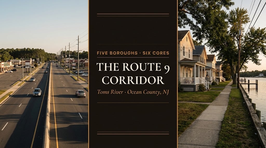
Here is something almost nobody in Toms River knows: the highway you drive through town and call Route 9 is mostly not Route 9. U.S. 9 uses the Garden State Parkway to bypass the township entirely — the road through town is Route 166, a 3.73-mile alternate alignment along Atlantic City Boulevard. That's not trivia. It's the first clue to a corridor where five separate municipalities, six designated planning Cores, and a declined highway widening all shape what your address is actually worth.
Four things about this corridor. The road: U.S. Route 9 bypasses Toms River by running along the Garden State Parkway, so the highway through town — the one along Atlantic City Boulevard from Beachwood up through South Toms River and across Route 37 — is Route 166, a 3.73-mile alternate alignment carrying a century of renumbering behind it. The municipalities: this corridor threads past five separate boroughs — Beachwood, Pine Beach, South Toms River, Island Heights, and Ocean Gate — each with its own government, its own tax rate, and in some cases its own school arrangements, none of which a mailing address reliably reveals. The plan: the State Development and Redevelopment Plan identifies six designated Cores in Toms River, including a Route 9 Highway Core, alongside two Downtown Regional Centers and a node — a map of where the state framework expects growth to concentrate. And the road's present: NJDOT withdrew a full widening in 2020 after pricing it at $555 million — the corridor is built out to the right-of-way — while a $48.5 million reconstruction of roughly seven miles between Toms River and Lakewood has been under construction since September 2022 and is now anticipated to be substantively complete by the end of 2026. Together those four facts explain why "on Route 9" means something different at every mile of this corridor.
This is the corridor spoke of our Toms River township guide. Highway project status and planning designations change — verify current details with NJDOT, the NJTPA, and the township before relying on any of it.
Start with the correction. U.S. Route 9 uses the Garden State Parkway to bypass Toms River — so the highway running through the heart of the township is New Jersey Route 166, a 3.73-mile state highway providing an alternate alignment of U.S. 9. It begins at an interchange with U.S. 9 northbound in Beachwood, runs north along Atlantic City Boulevard through South Toms River and into Toms River, crosses Route 37, and ends where U.S. 9 leaves the Parkway north of town.
The history explains the confusion. This right-of-way was designated New Jersey Route 4 in 1920, then U.S. Route 9 in 1927. When the Garden State Parkway was built, the highways were realigned and the original alignment became U.S. Route 9 Alternate in the 1950s, eventually replaced by Route 166 — an alignment unchanged since. Four designations, one road, a century of local habit calling it Route 9. Why it matters practically: when a listing says "convenient to Route 9," ask which one — proximity to the Parkway alignment and proximity to the Atlantic City Boulevard business strip are very different amenities, with different traffic, different commercial character, and different value implications.
The southern end of this corridor is not Toms River at all. Threaded along and around it sit five separate municipalities: Beachwood, Pine Beach, South Toms River, Island Heights, and Ocean Gate — each an independent borough with its own governing body, its own municipal budget, and its own tax rate. Some send students to Toms River Regional; others have different arrangements entirely.
This is the same lesson the rest of this cluster keeps producing, in a new place. Our schools guide documents it precisely: the 2026-27 regional school levy rose 4.9% district-wide but 11.4% in South Toms River, which carried a deferred increase from the prior year — roughly $20.64 more per month on a home assessed at $171,200. Same district, same schools, materially different bill. Add the township-versus-township spreads documented in our Brick and Jackson comparisons, and the rule for this corridor writes itself: confirm the taxing municipality from the tax record before you compare two listings. The mailing address will not tell you.
New Jersey's State Development and Redevelopment Plan maps designated Centers, Cores, and Nodes — a statement of state policy guiding where growth is expected to concentrate. Its policy map for Toms River identifies a striking number of them:
Route 9 Highway Core — the corridor itself
Route 37 West Core and Route 37 East Core — the cross-township spine
Fisher Boulevard Core North and Core South
Hooper Avenue Core South — the retail corridor
Downtown Regional Center East and West
Hickory Lane Node
The corridor's most concrete redevelopment action sits on Hooper Avenue. The township adopted the Hooper-Caudina Redevelopment Plan on February 26, 2019, amended it on May 26, 2020 to add Block 608, Lot 19.01 as "Subarea B," and in 2021 supported the efforts of its designated redeveloper. Its stated purpose is direct: enable major new facilities to reenergize existing retail centers along the Hooper Avenue corridor and support the economic viability of the Ocean County Mall. For anyone tracking where this township's commercial future is being steered, that sentence is the thesis — and it names the anchor whose health drives the whole retail corridor.
On the transportation side, the NJTPA's U.S. 9 Corridor Study (final report dated February 2017) fed recommendations into the township's master plan circulation element — including signalizing intersections, granting cross-access easements between adjacent properties, and completing local street connections designed to pull local trips off Route 9 entirely. Those connector improvements are the quiet kind of infrastructure that changes a neighborhood's traffic more than a highway project does.
Near a designated Core? Growth policy shapes what your parcel can become — and buyers rarely know to ask.
Get a valuation that accounts for your corridor position, the planning framework around you, and the correct taxing municipality — backed by the New York metro buyer pool we bring to every listing.
First, the project that died — and the reason, which is itself a land-use lesson. In 2015 the North Jersey Transportation Planning Authority presented plans for a center left-turning lane along this section of Route 9. In 2020, NJDOT withdrew it, and the explanation was specific: the proposal would have cost $555 million, because Route 9 is surrounded by a mix of residential and commercial properties, many with frontage and parking close to the right-of-way. Widening would have required extensive land acquisition, and the department did not have the funding.
Read that as a property owner rather than a commuter. The corridor is built out to the right-of-way. That's why a widening costs half a billion dollars, and it's why the strip's physical character is effectively fixed: the buildings and their parking are the constraint. Anyone underwriting a corridor-frontage parcel here should understand that the state has already priced expansion and walked away from it.
Second, the project that is happening right now. NJDOT broke ground in September 2022 on a $48.5 million reconstruction covering roughly seven miles of Route 9 from Indian Head Road in Toms River to 2nd Street in Lakewood — a 6.9-mile section running from Milepost 95.0 near Swain Avenue to Milepost 101.9. Delivered in six sections, the scope is substantial:
8 signalized intersections widened with added turn lanes
7 left-turn lanes added at unsignalized intersections
2 new traffic signals — at Oak Street and Broadway/Chateau Drive, both in Lakewood
Mainline widening at select locations for shoulder width and bicycle compatibility
Milling, paving and a High-Performance Thin Overlay across the corridor
Signals upgraded to current MUTCD and ADA standards
New and reconstructed sidewalks plus hundreds of ADA-compliant ramps
4 new stormwater basins and updated drainage piping
Third, and most useful for anyone buying here: it has run years late, and it is still running. NJDOT initially told local officials the work would take two to three years, targeting summer 2025. By July 2024, through public court filings, the department conceded it may take five years. As of mid-2026, the overall project is anticipated to be substantively completed by the end of 2026. Construction began with utility relocation — the majority of the water main work in Toms River is complete, and most overhead wires along the corridor have been moved. The delays have a documented cause: NJDOT has repeatedly gone to court to exercise eminent domain after property owners held up right-of-way acquisition.
The buyer's read. If you are purchasing along this corridor, three things follow. Active construction is a present condition, not a future one — visit at rush hour and expect lane patterns to shift as sections advance. The finished product is a genuine improvement: better pavement, more turn lanes, upgraded signals, real sidewalks and ADA ramps, and drainage brought to current standards. And frontage parcels may still face right-of-way questions until the last section closes out — if you're buying commercial or corridor-adjacent land, ask the township and NJDOT directly what remains outstanding on your block. Township context is in our complete guide, the pricing framework in our forensic market report, and current inventory on our listings page.
Anywhere along this corridor, your mailing address will not tell you your municipality. Postal boundaries and municipal boundaries were drawn by different people for different reasons, and along the southern stretch you can have a Toms River mailing address while paying taxes to a borough — or the reverse. Since the municipality sets your tax rate, your services, and your voting, that's not a technicality. Pull the tax record for the specific parcel, which names the taxing municipality outright, and do it before you compare two listings rather than after you've fallen for one. It takes two minutes and it is the single most common avoidable mistake buyers make on this corridor.
"I've had clients tell me they wanted to be 'right off Route 9' and mean two completely different roads. One meant the Parkway alignment and a fast run north; the other meant Atlantic City Boulevard, which is a business strip with a different life entirely — and is technically Route 166. That confusion runs through this whole corridor: the highway isn't what people call it, the town isn't always the town on the envelope, and the growth areas are mapped in a state document almost nobody reads. None of that is exotic knowledge. It's just knowledge nobody bothers to hand a buyer before they sign."
— Anthony Licciardello, Broker, The Prodigy Team
Reading master plans, corridor studies, and municipal boundaries is native ground for me: I'm Anthony Licciardello, Broker of The Prodigy Team — a former Director of Community Affairs in the Bloomberg Administration who learned planning from inside government, now dual-licensed in New York and New Jersey and a leading broker for cross-border New York–New Jersey transactions, bringing the New York market to New Jersey sellers.
Our Above the Streets cinematic drone series traces these corridors from the air — the clearest way to see where one town ends and the next begins — with audience performance exceeding industry benchmarks for real estate media.
Anthony Licciardello · Broker, The Prodigy Team · 718-873-7345
We confirm the municipality, read the planning framework, and price corridor position honestly.
Is Route 9 the same as Route 166 in Toms River?
No. U.S. Route 9 uses the Garden State Parkway to bypass Toms River, so the highway through town is Route 166 — a 3.73-mile alternate alignment of U.S. 9 running north along Atlantic City Boulevard from an interchange with U.S. 9 in Beachwood, through South Toms River, across Route 37, ending where U.S. 9 leaves the Parkway north of town. The right-of-way was designated Route 4 in 1920, U.S. 9 in 1927, and U.S. 9 Alternate in the 1950s before becoming Route 166.
What towns are along the Route 9 corridor south of Toms River?
Five separate boroughs sit along and around the southern corridor: Beachwood, Pine Beach, South Toms River, Island Heights, and Ocean Gate. Each is an independent municipality with its own government, budget, and tax rate. Mailing addresses do not reliably indicate the taxing municipality — confirm it from the property's tax record before comparing listings.
Where is growth directed in Toms River?
New Jersey's State Development and Redevelopment Plan policy map identifies designated Cores in Toms River including a Route 9 Highway Core, Route 37 West and East Cores, Fisher Boulevard Cores North and South, and a Hooper Avenue Core South, plus Downtown Regional Centers East and West and a Hickory Lane Node. Locally, the Hooper-Caudina Redevelopment Plan — adopted February 26, 2019 and amended May 26, 2020 — aims to enable major new facilities reenergizing retail along Hooper Avenue and support the Ocean County Mall's viability.
Is Route 9 being widened in Toms River?
Partly. NJDOT withdrew a full center-turn-lane widening in 2020 after pricing it at $555 million, explaining that the corridor's buildings and parking sit close to the right-of-way and the land acquisition was unaffordable. A narrower $48.5 million reconstruction has been under construction since September 2022, covering roughly seven miles from Indian Head Road in Toms River to 2nd Street in Lakewood — widening 8 signalized intersections, adding 7 left-turn lanes and 2 new signals, with new sidewalks, ADA ramps and drainage. Originally targeted for summer 2025, it is now anticipated to be substantively completed by the end of 2026.
New Construction in Toms River — Three Pipelines
Moving to Toms River — The Complete Township Guide
Toms River Schools — The Complete Guide for Buyers
Toms River Property Taxes — What You Actually Pay
Commuting from Toms River — The Honest Guide
Downtown & the Waterfront — Towers, Termination, Reversal
Toms River Homes for Sale — Browse Current Listings
Details as of publication for Toms River Township and the surrounding Route 9 corridor, Ocean County, NJ, from the sources noted: New Jersey Route 166 described as a 3.73-mile state highway maintained by NJDOT, existing since 1954, providing an alternate alignment of U.S. Route 9 through South Toms River and Toms River, with its southern terminus at an intersection with U.S. Route 9 northbound along Atlantic City Boulevard in Beachwood, a junction with Route 37 in Toms River, and a northern end at the Garden State Parkway and U.S. 9 north of Toms River, with U.S. 9 itself using the Garden State Parkway to bypass Toms River; the right-of-way described as a former alignment of New Jersey Route 4 designated in 1920 and U.S. Route 9 designated in 1927, realigned when the Garden State Parkway was built, becoming U.S. Route 9 Alternate in the 1950s and eventually Route 166, with the alignment unchanged since. Transportation project details: a 2015 North Jersey Transportation Planning Authority proposal for a center left-turning lane along this section of Route 9, withdrawn by NJDOT in 2020 at a stated cost of $555 million, with the department explaining that Route 9 is surrounded by a mix of residential and commercial properties, many with frontage and parking close to the right-of-way, such that the resulting widening would have required extensive land acquisition and significant costs for which it lacked funding, per FAA News reporting; a $48.5 million NJDOT pavement preservation, congestion relief and intersection widening project begun in September 2022, addressing deficient pavement along a 6.9-mile section of Route 9 between Milepost 95.0 near Swain Avenue in Toms River and Milepost 101.9 near 2nd Street in Lakewood — described in press coverage as resurfacing approximately seven miles from Indian Head Road in Toms River to 2nd Street in Lakewood — delivered in six sections and including the widening of 8 signalized intersections with added turn lanes, the addition of 7 left-turn lanes at unsignalized intersections, 2 new traffic signals at Oak Street and the Broadway/Chateau Drive intersection in Lakewood, mainline widening at select locations for increased outside shoulder width and bicycle compatibility, milling and paving with an additional High-Performance Thin Overlay, signal upgrades to current MUTCD and ADA standards, new and reconstructed sidewalks with hundreds of ADA-compliant ramps, and four new stormwater basins with updated piping, per NJDOT announcements reported by Patch, New Jersey 101.5 and Lakewood Alerts (published sidewalk figures vary between approximately two miles of new sidewalks and 1.6 miles of new plus almost 6 miles of reconstructed sidewalks); an original completion target of summer 2025 with NJDOT initially indicating two to three years, revised after the department conceded through public court filings in 2024 that the project may take five years, and reported as of July 2026 to be anticipated substantively complete by the end of 2026; and repeated NJDOT eminent domain filings following property-owner delays to right-of-way acquisition, with the majority of Toms River water main relocation complete and most overhead utility wires relocated along the corridor, per FAA News reporting. Planning details: the New Jersey State Development and Redevelopment Plan policy map (dated August 6, 2020) identifying designated Cores in Toms River including Route 9 Highway Core, Route 37 West Core, Route 37 East Core, Fisher Boulevard Core North, Fisher Boulevard Core South, and Hooper Avenue Core South, along with Downtown Regional Center East and West and a Hickory Lane Node, and noting that the State Plan is a statement of State policy rather than a regulation; the Township of Toms River's Economic Development and Redevelopment materials describing the Hooper-Caudina Redevelopment Plan as adopted by Township Council on February 26, 2019 and amended to include Block 608, Lot 19.01 as "Subarea B" on May 26, 2020, with the Township supporting its designated redeveloper in 2021, and stating the objective of enabling major new facilities to reenergize existing retail centers along the Hooper Avenue corridor and support the economic viability of the Ocean County Mall; and the NJTPA U.S. 9 Corridor Study final report dated February 28, 2017, whose recommendations are referenced in the Township's Master Plan Circulation Plan Element, including signalization and cross-access easement recommendations and local street connections intended to reduce local traffic on Route 9. School levy details per our schools guide: a 2026-27 Toms River Regional tax levy increase of 4.9% overall and 11.4% in South Toms River, the latter including a deferred increase from 2025-26 and equating to approximately $20.64 per month on a home assessed at $171,200. Municipal boundaries do not correspond to postal addresses; the taxing municipality for any property must be confirmed from its tax record. Highway project statuses, planning designations, redevelopment plans, and tax rates change; construction schedules on this project have already been revised more than once. This is general information and market commentary, not legal, planning, tax, or investment advice — verify all current details with NJDOT, the NJTPA, Toms River Township, the relevant boroughs, and your own professionals before acting.
Prodigy Real Estate is an innovative real estate company offering high-end video production, home valuation services, purchasing, and home sales. Serving New York and New Jersey.