
Anthony Licciardello | May 23, 2026
Summit, NJ
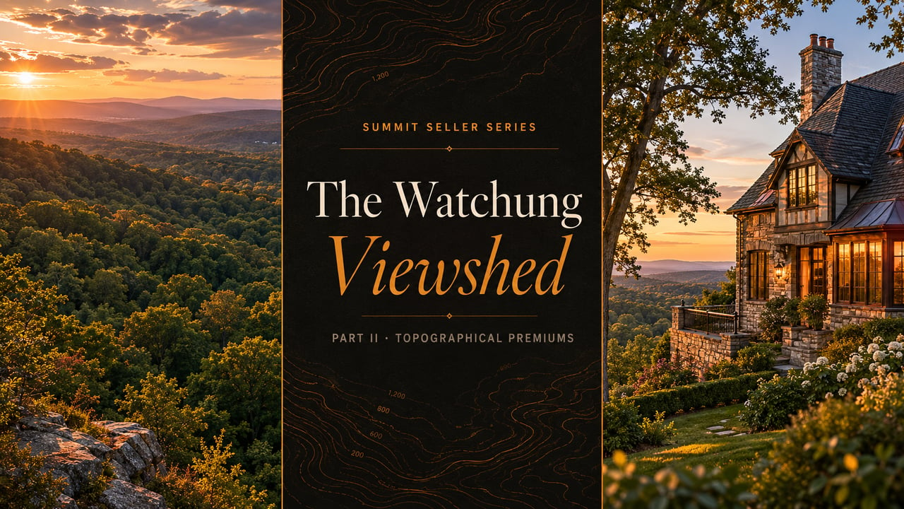
Altitude Is a Coordinate. Viewshed Is an Asset.
Summit's Watchung Ridge confuses sellers, automated valuation models, and occasionally even appraisers — because the premium they are all trying to price is not the number printed on the topographic map. The asset buyers actually pay for is line-of-sight, and almost no listing in Summit documents it correctly.

Altitude is what GIS records. Viewshed is what buyers experience standing on the back deck. Two Summit homes at identical elevations can hold radically different real-estate value depending on a handful of geometric variables that almost no listing in town documents correctly. The hedonic literature has known this for decades. Summit's sellers, by and large, still price by feet-above-sea-level — and leave the actual amenity premium on the table.
Part I of this series argued that Summit's residential geography is governed by three discrete pricing rings — a Pedestrian Zone where transit dominates, a Middle Ring where infrastructure access historically suppressed values, and an Outer Ring where the calculus inverts and topographical premiums take over. That last ring is where this post lives. Once you are beyond roughly two miles of the train station, the bid-rent curve stops bending downward and starts bending upward again, and the variable doing the work is not, despite every listing description in town suggesting otherwise, elevation.
A Summit home at 510 feet of altitude can sit ringed by mature oaks with no usable line of sight in any direction. A second home at 380 feet can sit on a cleared western edge of the ridge with an unobstructed view across two thousand acres of permanent protected canopy. The first home is, by the only number any automated valuation model can see, the more elevated property. The second home is, by every empirical measure of what buyers actually pay for, the more valuable one. The spatial hedonic literature has documented this distinction since the early 2000s; in Summit it remains an unevenly applied insight, with predictable consequences for sellers who lead with the wrong variable.
This post takes the viewshed problem apart in detail — what viewshed actually is in geometric terms, how the Watchung Ridge's specific geology and orientation create the local opportunity, how to document the asset for a listing, and how to translate it into a defensible list price. Sellers in the upper Franklin Hill sections, the ridge-line streets near the Watchung Reservation, and the elevated western parcels of the city are the primary audience. Sellers in the valley are the secondary audience, because understanding what the Outer Ring is competing with sharpens the listing strategy in every other ring.
Open any MLS listing in Summit's Outer Ring and the phrasing is almost identical from one to the next. Elevated location. Hilltop setting. Panoramic possibilities. The words evoke value but they describe a coordinate — the same coordinate Google Maps already shows the buyer on her phone before she has read the first line of copy. Altitude tells you where a property sits on a topographic survey. It tells you almost nothing about whether the property has the amenity buyers are actually willing to pay a substantial premium for.
The hedonic pricing literature has spent the better part of three decades unpicking this. A 2009 study of spatial hedonic models in Haifa, Israel — a city whose terrain bears some resemblance to Summit's, with elevated residential neighborhoods overlooking a mixed landscape — found that the viewshed effect on housing prices is consistently overstated when researchers use simple altitude as the input variable, and consistently understated when they fail to control for it altogether. The economic value of elevation is, the authors concluded, fundamentally a function of geometric visibility from the property itself, accounting for the localized physical obstacles that might impede lines of sight. Differences in height matter. So do pointing angle, horizontal orientation, the height of intervening tree canopy, the height of neighboring rooflines, and the quality of whatever sits at the end of the sightline.
In practical Summit terms: a parcel at 450 feet of elevation on the upper Franklin Hill ridge that has been clear-cut to a 90-degree western exposure carries an entirely different asset bundle than a parcel at 470 feet that is encircled by 60-foot oaks dropping eight feet of leaf litter every fall. The first parcel commands a true viewshed premium. The second parcel commands a privacy premium — a real and valuable amenity, but a structurally different one, and one that should be marketed under a different listing logic. Conflating the two is the most common pricing error in the Outer Ring.
The MLS field structure does not help. The standard "View" attribute in most New Jersey MLS instances is a binary yes-or-no, occasionally accompanied by a short free-text descriptor. There is no field for azimuth, no field for unobstructed distance, no field for the seasonal change in foliage, no field for the permanence of the view (whether it depends on a neighbor's tree that could be removed next year or on protected park land that will exist in perpetuity). The seller and their agent are left to communicate all of this in listing prose — and most listing prose does not bother. It says "elevated." It calls the property "set on a hilltop." Those phrases earn no premium, because they describe nothing.
Altitude is a coordinate. Viewshed is an asset. Sellers who lead with the first are pricing a number on a topographic map. Sellers who document the second are pricing the actual thing buyers fly out to see.
The geometric definition of a viewshed is simple once it is unpacked. From any single point on a residential parcel — the back deck, the primary bedroom window, the kitchen sink — the property's viewshed is the set of every point in the surrounding landscape that can be reached by an unobstructed straight line. The economic value of that viewshed is a function of four independent variables, and the listing strategy that maximizes the price has to address each one in turn.
The compass direction of the primary sightline. In Summit, western azimuths over the Watchung Reservation carry the deepest premium because the target is permanent protected canopy. Eastern and northern azimuths face residential parcels and are inherently more fragile.
The vertical angle of the sightline above the horizontal. Slightly downward sightlines across a tree canopy — the classic ridge view — tend to carry the highest premium. Sharply upward angles into adjacent hillsides do not.
How far the sightline travels before the first obstruction. A 300-foot view to a wall of neighboring trees is a different asset than a three-mile view to a distant ridge silhouette. The latter sells.
What is actually at the end of the sightline, and whether it is permanent. A view over the Watchung Reservation is structurally protected by state park designation. A view over a neighbor's lot is one variance application away from becoming a view of someone's roof.
These four variables interact multiplicatively, not additively. A high-quality target seen at a poor azimuth from an obstructed sightline produces almost no measurable premium. Two mediocre variables and two excellent ones can still produce a meaningful price effect if the combination tells a coherent story for a buyer. Three excellent variables and one poor one — for instance, a sweeping western view over the Reservation that is interrupted by a single neighbor's mature spruce — produces a frustrating asset, because the buyer can see exactly what the property would be worth if the obstruction were removed, and prices the home as if it were.
For listing strategy, the practical takeaway is to score the parcel honestly on all four variables before writing a word of copy, photographing a single frame, or pricing the property against a comp set. Homes in the Northside ridge sections often score brilliantly on azimuth and target quality but poorly on unobstructed distance because of close-set neighboring lots. Homes on the western edges of the Watchung ridge often score brilliantly on all four but get marketed identically to homes that score on only two. The mismatch is the seller's opportunity.
The Watchung Mountains are not, geologically, mountains. They are basalt ridges formed approximately 200 million years ago when tholeiitic lava flows poured across what is now the Newark Basin, cooling into successive flat sheets of dense, dark rock. The Preakness Basalt, which forms Summit's portion of the Second Watchung Mountain, conformably overlies the older Feltville Formation, and the entire structure was subsequently sculpted by the terminal moraine of the Wisconsin Glaciation roughly 20,000 years ago. The result is a long, north-south-trending ridge with steep western and eastern flanks, a relatively level crest line, and a complex set of buried valleys cut by glacial meltwater.
For a Summit seller, the geological history matters because it determines which orientations of the ridge produce which kinds of viewshed. The western flank of the ridge, where Summit's most prestigious residential parcels are concentrated, looks down across the Passaic River valley and the protected canopy of the Watchung Reservation — over two thousand acres of permanently preserved Union County parkland. This is the most valuable view in the city, because the target is permanent: no zoning variance, no developer's site plan, no neighbor's renovation can put a structure between a western-facing Summit home and the Reservation canopy. The view is, in spatial-economics terms, infrastructurally permanent.
The eastern flank of the ridge tells a different story. Eastern azimuths from Summit's ridge homes look out across the residential grid of Springfield, Maplewood, and on clear days, the distant Manhattan skyline. The view is dramatic but architecturally fragile. Every house that gets a third story, every new development that adds elevation, every mature tree that grows another fifteen feet, can erode the asset. Eastern viewshed sellers should price conservatively and document the current state of the view with timestamped photography, because the buyer is taking on more long-term uncertainty than the seller may realize.
The northern azimuth in Summit is structurally the most variable of the four. Some northern-facing parcels look across protected open space; others look across high-density residential blocks where the next decade of renovations and additions will reshape the viewshed entirely. A seller marketing a northern-azimuth viewshed should be explicit about what currently sits in the sightline and what is zoned to potentially sit there in the future. Buyers who understand the distinction will pay accordingly; buyers who don't will discover it eighteen months after closing and resent the seller for it.
A western view in Summit is permanent. An eastern view is borrowed. The difference is worth understanding before you price the property, not after the buyer's inspection.
An undocumented viewshed is, for pricing purposes, an undocumented asset — and undocumented assets sell at a discount. The listing strategy that captures the true viewshed premium begins with documentation, runs through visual presentation, and ends with appraisal-defensible commentary in the listing remarks. None of this is cosmetic. Each piece serves a specific function in the chain that connects the seller's claimed list price to the buyer's willingness to pay to the appraiser's defensible comparable analysis.
The first piece is aerial drone imagery shot at the property's actual viewing elevations. Drone footage flown at the height of the back deck, at the height of the primary bedroom window, and at the highest point of the property's interior creates a visual record that ground-level photography simply cannot replicate. Ground photos of a viewshed almost always look flat and disappointing because the human eye corrects for perspective in person but the camera does not. Drone photography corrects the correction. This is one of the reasons The Prodigy Team's Above the Streets drone series exists; the visual asset is a marketing tool and a documentation tool simultaneously.
The second piece is seasonal documentation. A viewshed that is spectacular in winter, when leaves are off the canopy, can be dramatically reduced in summer, when the canopy fills in. A viewshed that is consistent across all four seasons — rare in Summit, common only in the most exposed western-edge parcels — carries a premium of its own. The seller's documentation should include leaves-on and leaves-off imagery, and the listing remarks should be explicit about how the viewshed changes through the year. This is not a defensive disclosure. It is a positioning tool. The buyer who sees both seasons documented understands the property better and trusts the listing more.
The third piece is the GIS viewshed analysis — a geometric calculation, available through public-domain tools, that maps every parcel and structure visible from a given point on the property. For higher-priced listings, including a one-page viewshed analysis in the marketing collateral is the kind of detail that signals competence to sophisticated buyers and gives the appraiser a defensible artifact for the comparable analysis. The cost is trivial. The signal is significant. Sellers in the Edgewood section and the upper ridge parcels should treat this as standard, not exceptional.
The mature tree canopy that makes Summit one of the most beautiful suburbs in northern New Jersey is also the single largest obstacle to viewshed in the city. This is the canopy paradox, and it sits at the center of every honest pricing conversation in the Outer Ring. Mature oaks, beeches, and tulip poplars on a residential parcel are themselves an amenity — they signal privacy, age, prestige, and a kind of pastoral character that newer construction cannot replicate. They are also, on average, between 60 and 90 feet tall, and they are between the seller's house and any viewshed the property might otherwise possess.
Sellers in this position have to make a choice that is partly about pricing strategy and partly about identity. The choice is whether to lead the listing with viewshed (cleared sightlines, distant horizons) or with privacy (enclosed canopy, sheltered grounds). Both are real assets. Both command premiums. But they reach different buyers, and a listing that tries to claim both simultaneously will land on neither.
The third option — and the one most underutilized in Summit listings — is the treetop view. A home positioned high enough on the ridge that its main living levels look across the canopy rather than into it can claim a distinct amenity that is rarer and arguably more compelling than either pure viewshed or pure privacy. The treetop view turns the canopy from an obstruction into the foreground subject. A buyer looking out from a third-floor bedroom over a sea of green oak crowns is not buying a "view of the trees." She is buying a view over the trees. The framing matters.
Decide whether you are selling a viewshed, a privacy buffer, or a treetop view — then commit. The listings that try to be all three at once are the ones that sit on the market.
The viewshed premium is not a fixed dollar amount. It is a function of the four geometric variables in Chapter II combined with the local rarity of the asset within the relevant comp set. A western viewshed across the Watchung Reservation is rare in absolute terms but not in the upper Franklin Hill comp set, where many parcels share the same orientation. The same viewshed in a Wyoming-area parcel would be extraordinary and would command a correspondingly larger premium because the local comp set contains nothing comparable.
The seller's pricing exercise, then, has two parts. First, score the parcel honestly on the four geometric variables. Second, compare that score against the comp set within roughly half a mile of the property to identify whether the viewshed is rare or typical for the local market. A typical viewshed within a typically-viewshed neighborhood adds little; a rare or best-in-class viewshed within the same neighborhood compounds the premium meaningfully.
A typical viewshed in a typical-viewshed neighborhood adds little to a list price. A best-in-class viewshed in the same neighborhood compounds it. Knowing which you have is the entire pricing exercise.
| Viewshed Tier | Geometric Profile | Listing Strategy | Premium Direction |
|---|---|---|---|
| I · Permanent Reservation-facing |
Western azimuth, unobstructed, multi-mile target, infrastructurally protected | Lead with viewshed; treat it as the primary asset | Highest — full capitalization defensible |
| II · Treetop Over-canopy |
Elevated sightline across local canopy; foreground is the trees themselves | Frame the canopy as the subject, not the obstruction | Strong — often underpriced because misframed |
| III · Seasonal Winter-only |
Strong leaves-off viewshed, mostly obscured in summer | Document both seasons explicitly; do not oversell | Modest — honest framing protects buyer trust |
| IV · Altitude Only No usable sightline |
Elevated parcel but obstructed in every direction by mature canopy | Lead with privacy and grounds, not "elevation" | Reframe as privacy asset; do not chase a viewshed premium |
The single most expensive pricing mistake in the Outer Ring is the Tier IV property listed as if it were Tier I — an obstructed parcel marketed on the strength of its altitude. The market detects this almost immediately. Days on market extend, price reductions follow, and the eventual sale price often sits well below where an honest privacy-focused listing would have landed in the first place. The second most expensive mistake is the Tier II treetop property listed as if it were Tier IV: a genuinely compelling over-canopy view dismissed in the listing remarks as "wooded lot" and priced accordingly. Both errors are correctable. Both require the seller to score the parcel honestly before the comp analysis begins.
Part III of this series, releasing next, turns to the Middle Ring and the post-2016 rideshare revaluation — the band of Summit's geography where the largest hidden seller premium currently sits, and the one most consistently missed by automated valuation models. The viewshed framework here in Part II becomes part of that larger calculation: many Middle Ring parcels also carry modest viewshed assets that compound with the access-cost story to produce a list price meaningfully above what the algorithms will suggest.
Begin with the four geometric variables: azimuth (compass direction of the primary sightline), elevation angle (how far above or below horizontal), unobstructed distance (how far the sightline travels before the first major obstacle), and target quality and permanence (what is at the end of the sightline, and whether it is protected). A drone flight at deck height across the property's four main orientations will give you most of what you need to begin scoring honestly.
Automated valuation models have, at best, access to a parcel's altitude. They have no geometric model of what the sightlines from that parcel actually reach, no model of the surrounding canopy, and no model of the permanence of the target. The "view" field in the MLS is typically a binary yes-or-no, which the AVM can read but cannot weigh. Two homes at identical altitude and identical square footage with radically different viewsheds will be priced almost identically by Zillow and Redfin. This is the largest single systematic mispricing in Summit's Outer Ring.
Almost never, and never without consulting the city's tree ordinance and shade tree commission first. Mature trees on the property are typically themselves an amenity, and removing them can simultaneously reduce one asset (privacy, canopy character) while only partially restoring another (viewshed). The exception is selective limbing or removal of dead or diseased trees along a clearly defined western sightline, which can sometimes meaningfully upgrade a Tier II treetop view toward Tier I. Always document the change with before-and-after photography for the listing.
Include both seasons in the listing collateral, explicitly. Leaves-off imagery in the main gallery, leaves-on imagery in a supplemental section or virtual tour, and a single sentence in the listing remarks that names the seasonal change directly. Honesty here protects the eventual sale price and the buyer's trust, both of which matter more than a marginally stronger photo set.
Part III covers the Middle Ring revaluation: the band of Summit's geography between 0.5 and 2.0 miles from the train station, where the 2016 municipal rideshare program functionally removed the parking constraint that had been suppressing values for decades. It is the most contrarian post in the series and the one most likely to surprise sellers who assume their AVM estimate reflects current market reality.
A 30-minute viewshed and pricing audit with The Prodigy Team covers azimuth scoring, sightline documentation, comp-set viewshed comparison, and a market-defensible list-price recommendation grounded in the framework above.
Request Your AuditProdigy Real Estate is an innovative real estate company offering high-end video production, home valuation services, purchasing, and home sales. Serving New York and New Jersey.